#militaryspace

posts tagged #militaryspace

0

AST SpaceMobile Awarded U.S. Space Force Contract Through STR to Advance Space-Based Sensing Capabilities

preview

Award supports use of commercial space technology for government applications beyond communications

AST SpaceMobile, Inc. (“AST SpaceMobile”) (NASDAQ: ASTS), the company building the first and only space-based cellular broadband network accessible directly by everyday smartphones, designed for both commercial and government applications, today announced it will support STR, the prime contractor, under a U.S. Space Force (USSF) contract.

Award supports use of commercial space technology for government applications beyond communications

AST SpaceMobile, Inc. (“AST SpaceMobile”) (NASDAQ: ASTS), the company building the first and only space-based cellular broadband network accessible directly by everyday smartphones, designed for both commercial and government applications, today announced it will support STR, the prime contractor, under a U.S. Space Force (USSF) contract.

0

[Andrew Parsonson] New EU sanctions target leaders of Russia’s space industry

SpaceNews New EU sanctions target leaders of Russia’s space industry spacenews.com
preview
Article text

Andrew Parsonson ~4 minutes JOHANNESBURG — The European Union has sanctioned the head of a Roscosmos subsidiary developing a synthetic aperture radar satellite system for the Russian military. The sanctions are part of what the bloc says is a broader effort to target Russia’s military space sector over its support for the war in Ukraine. On Aug. 7, the European Union added five Russian defense industry executives to its sanctions list, including Viktor Ivanov, director general of Roscosmos subsidiary NII TP, the developer of the Kasatka-R synthetic aperture radar system. The designation builds on previous EU sanctions imposed on the company itself, extending the pressure beyond its limited commercial exposure to the individuals running Russia’s military-industrial organizations. EU spokesperson Anitta Hipper told SpaceNews that the designation “sends a signal to other personnel working in Russia’s defence-industrial base that personal involvement in supporting the war effort carries direct, individual consequences.” Hipper explained that space and satellite technology had become “increasingly relevant” to EU sanctions because of their roles in reconnaissance, targeting and communications used by Russia in its “war of aggression against Ukraine.” “This designation fits into a broader effort to map and sanction the ecosystem around Russia’s military-industrial complex, including the military space sector that develops and produces technology and equipment used by the Russian military, thereby enabling Russia’s war efforts,” she said. Under the sanctions, any assets Ivanov holds in the EU are frozen, EU persons and entities are prohibited from making funds or economic resources available to him, and he is barred from entering or transiting through EU territory. Those individual restrictions come on top of measures already imposed on NII TP itself. The company was added to the EU sanctions list on June 15 as part of a broader package targeting Russia’s military-industrial complex, nearly three years after the U.S. Treasury Department imposed sanctions on the institute in July 2023. Hipper did not say why the bloc had moved against Ivanov personally less than two months after sanctioning NII TP, except that “sanctions are dynamic and part of a continuously evolving process” and that the discussions “are confidential and fully in the hands of the member states.” Ivanov was not the only individual sanctioned Aug. 7 with ties to Russia’s space sector. The EU also sanctioned Sergey Bashkov, director of Irz-Svyaz, which the bloc described as a systemically important Russian manufacturer of navigation receivers for GPS and the Russian GLONASS satellite navigation system. Aleksandr Dyukarev, director general of Krasnoyarsk Machine-Building Plant, was also listed. The company manufactures the RS-28 Sarmat intercontinental ballistic missile as well as modules for carrier rockets.

Article text

Andrew Parsonson ~4 minutes JOHANNESBURG — The European Union has sanctioned the head of a Roscosmos subsidiary developing a synthetic aperture radar satellite system for the Russian military. The sanctions are part of what the bloc says is a broader effort to target Russia’s military space sector over its support for the war in Ukraine. On Aug. 7, the European Union added five Russian defense industry executives to its sanctions list, including Viktor Ivanov, director general of Roscosmos subsidiary NII TP, the developer of the Kasatka-R synthetic aperture radar system. The designation builds on previous EU sanctions imposed on the company itself, extending the pressure beyond its limited commercial exposure to the individuals running Russia’s military-industrial organizations. EU spokesperson Anitta Hipper told SpaceNews that the designation “sends a signal to other personnel working in Russia’s defence-industrial base that personal involvement in supporting the war effort carries direct, individual consequences.” Hipper explained that space and satellite technology had become “increasingly relevant” to EU sanctions because of their roles in reconnaissance, targeting and communications used by Russia in its “war of aggression against Ukraine.” “This designation fits into a broader effort to map and sanction the ecosystem around Russia’s military-industrial complex, including the military space sector that develops and produces technology and equipment used by the Russian military, thereby enabling Russia’s war efforts,” she said. Under the sanctions, any assets Ivanov holds in the EU are frozen, EU persons and entities are prohibited from making funds or economic resources available to him, and he is barred from entering or transiting through EU territory. Those individual restrictions come on top of measures already imposed on NII TP itself. The company was added to the EU sanctions list on June 15 as part of a broader package targeting Russia’s military-industrial complex, nearly three years after the U.S. Treasury Department imposed sanctions on the institute in July 2023. Hipper did not say why the bloc had moved against Ivanov personally less than two months after sanctioning NII TP, except that “sanctions are dynamic and part of a continuously evolving process” and that the discussions “are confidential and fully in the hands of the member states.” Ivanov was not the only individual sanctioned Aug. 7 with ties to Russia’s space sector. The EU also sanctioned Sergey Bashkov, director of Irz-Svyaz, which the bloc described as a systemically important Russian manufacturer of navigation receivers for GPS and the Russian GLONASS satellite navigation system. Aleksandr Dyukarev, director general of Krasnoyarsk Machine-Building Plant, was also listed. The company manufactures the RS-28 Sarmat intercontinental ballistic missile as well as modules for carrier rockets.

0

[Sandra Erwin] Space Force orders two more Impulse Space vehicles for maneuvering demonstrations

SpaceNews Space Force orders two more Impulse Space vehicles for maneuvering demonstrations spacenews.com
preview
Article text

Sandra Erwin 3–4 minutes Impulse Space’s Mira spacecraft. Credit: Impulse Space HUNTSVILLE, Ala. — The U.S. Space Force has added $28 million to an existing contract with Impulse Space to provide two more maneuverable spacecraft for tactically responsive space missions, expanding the startup’s role in an effort to give military operators faster options for responding to activity in orbit. The contract modification will fund Victus Salo 2 and Victus Salo 3, which will use Impulse’s Mira spacecraft to host government-provided payloads for missions in low Earth orbit, according to the Space Force. The award increases the value of the contract to about $62.8 million. The original $34.8 million Small Business Innovation Research Phase 3 agreement, awarded in 2024 by Space Systems Command’s Space Safari office in partnership with the Defense Innovation Unit, covered the Victus Surgo and Victus Salo 1 missions. Victus Salo is part of the Space Force’s broader Tactically Responsive Space, or TacRS, effort to shorten the time needed to deploy and operate spacecraft. Under Victus Salo, the Space Force is moving beyond its earlier focus on rapid launch to also test spacecraft that can be positioned in orbit and maneuvered quickly when circumstances change. The first Victus Salo mission calls for a Mira vehicle to operate in low Earth orbit carrying a government payload supplied by Massachusetts Institute of Technology Lincoln Laboratory. Victus Salo 1 is currently expected to launch in 2027. Victus Surgo is more ambitious: an Impulse Helios high-energy kick stage is intended to carry another Mira spacecraft from low Earth orbit toward geosynchronous transfer orbit, where Mira would maneuver independently. Mira is a high-thrust spacecraft that can host and deploy payloads and make relatively rapid orbital maneuvers using chemical propulsion. Impulse says the vehicle can carry payloads of up to 300 kilograms and uses eight thrusters burning nitrous oxide and ethane. The company has flown Mira on three missions. Impulse, founded in 2021 by former SpaceX propulsion executive Tom Mueller, is building spacecraft and propulsion systems intended to provide transportation after a payload has separated from its launch vehicle. Impulse has been moving deeper into the Pentagon’s launch and space-mobility market. The Space Force last month added the company to the National Security Space Launch Phase 3 Lane 1 contract, allowing Impulse to compete as an upper-stage provider.

Article text

Sandra Erwin 3–4 minutes Impulse Space’s Mira spacecraft. Credit: Impulse Space HUNTSVILLE, Ala. — The U.S. Space Force has added $28 million to an existing contract with Impulse Space to provide two more maneuverable spacecraft for tactically responsive space missions, expanding the startup’s role in an effort to give military operators faster options for responding to activity in orbit. The contract modification will fund Victus Salo 2 and Victus Salo 3, which will use Impulse’s Mira spacecraft to host government-provided payloads for missions in low Earth orbit, according to the Space Force. The award increases the value of the contract to about $62.8 million. The original $34.8 million Small Business Innovation Research Phase 3 agreement, awarded in 2024 by Space Systems Command’s Space Safari office in partnership with the Defense Innovation Unit, covered the Victus Surgo and Victus Salo 1 missions. Victus Salo is part of the Space Force’s broader Tactically Responsive Space, or TacRS, effort to shorten the time needed to deploy and operate spacecraft. Under Victus Salo, the Space Force is moving beyond its earlier focus on rapid launch to also test spacecraft that can be positioned in orbit and maneuvered quickly when circumstances change. The first Victus Salo mission calls for a Mira vehicle to operate in low Earth orbit carrying a government payload supplied by Massachusetts Institute of Technology Lincoln Laboratory. Victus Salo 1 is currently expected to launch in 2027. Victus Surgo is more ambitious: an Impulse Helios high-energy kick stage is intended to carry another Mira spacecraft from low Earth orbit toward geosynchronous transfer orbit, where Mira would maneuver independently. Mira is a high-thrust spacecraft that can host and deploy payloads and make relatively rapid orbital maneuvers using chemical propulsion. Impulse says the vehicle can carry payloads of up to 300 kilograms and uses eight thrusters burning nitrous oxide and ethane. The company has flown Mira on three missions. Impulse, founded in 2021 by former SpaceX propulsion executive Tom Mueller, is building spacecraft and propulsion systems intended to provide transportation after a payload has separated from its launch vehicle. Impulse has been moving deeper into the Pentagon’s launch and space-mobility market. The Space Force last month added the company to the National Security Space Launch Phase 3 Lane 1 contract, allowing Impulse to compete as an upper-stage provider.

0

[Sandra Erwin] Space Force triples launch contract ceiling amid rising demand

SpaceNews Space Force triples launch contract ceiling amid rising demand spacenews.com
preview
Article text

Sandra Erwin 3–4 minutes WASHINGTON — The U.S. Space Force has more than tripled the ceiling of a major national security launch contract to $17 billion as the military prepares for a sharp increase in satellite missions. The Space Force raised the maximum value of the National Security Space Launch Phase 3 Lane 1 contract vehicle from $5.6 billion to $17 billion, according to a July 17 notice. The increase substantially expands the amount the service can spend on launch task orders competed among seven companies through fiscal 2029. The higher ceiling sets the maximum cumulative value of task orders that can be placed under the Lane 1 contracts. Providers must compete for individual missions and meet applicable flight-readiness requirements before they are eligible to bid. The seven companies in the Lane 1 vendor pool are SpaceX, United Launch Alliance, Blue Origin, Rocket Lab, Stoke Space, Impulse Space and Relativity Space. Lane 1 is the commercial-style portion of the Space Force’s main launch procurement program. It covers missions that don’t require the full certification and mission-assurance procedures reserved for the military’s most complex and sensitive satellites. Companies admitted to the multiple-award, indefinite-delivery, indefinite-quantity contract become eligible to compete for task orders as missions arise. The structure is intended to expand competition by giving newer providers a path into the national security market once their vehicles or transportation systems have demonstrated sufficient readiness. That distinguishes Lane 1 from Phase 3 Lane 2, which covers the government’s highest-priority missions and is limited to providers with launch systems certified under the National Security Space Launch program. The expanded Lane 1 ceiling follows a separate increase in demand for the Space Force’s most complex launches. In April, Space Systems Command said it had identified 25 additional Phase 3 Lane 2 missions beyond the 54 launches originally planned over five years. Taken together, the higher Lane 1 ceiling and the 25 additional Lane 2 missions show that the military’s projected launch needs have expanded sharply since the Phase 3 acquisition strategy was established in 2024.

Article text

Sandra Erwin 3–4 minutes WASHINGTON — The U.S. Space Force has more than tripled the ceiling of a major national security launch contract to $17 billion as the military prepares for a sharp increase in satellite missions. The Space Force raised the maximum value of the National Security Space Launch Phase 3 Lane 1 contract vehicle from $5.6 billion to $17 billion, according to a July 17 notice. The increase substantially expands the amount the service can spend on launch task orders competed among seven companies through fiscal 2029. The higher ceiling sets the maximum cumulative value of task orders that can be placed under the Lane 1 contracts. Providers must compete for individual missions and meet applicable flight-readiness requirements before they are eligible to bid. The seven companies in the Lane 1 vendor pool are SpaceX, United Launch Alliance, Blue Origin, Rocket Lab, Stoke Space, Impulse Space and Relativity Space. Lane 1 is the commercial-style portion of the Space Force’s main launch procurement program. It covers missions that don’t require the full certification and mission-assurance procedures reserved for the military’s most complex and sensitive satellites. Companies admitted to the multiple-award, indefinite-delivery, indefinite-quantity contract become eligible to compete for task orders as missions arise. The structure is intended to expand competition by giving newer providers a path into the national security market once their vehicles or transportation systems have demonstrated sufficient readiness. That distinguishes Lane 1 from Phase 3 Lane 2, which covers the government’s highest-priority missions and is limited to providers with launch systems certified under the National Security Space Launch program. The expanded Lane 1 ceiling follows a separate increase in demand for the Space Force’s most complex launches. In April, Space Systems Command said it had identified 25 additional Phase 3 Lane 2 missions beyond the 54 launches originally planned over five years. Taken together, the higher Lane 1 ceiling and the 25 additional Lane 2 missions show that the military’s projected launch needs have expanded sharply since the Phase 3 acquisition strategy was established in 2024.

0

[Karthik Vinod] Nature study identifies a new way to spot nuclear weapons in orbit

SpaceNews Nature study identifies a new way to spot nuclear weapons in orbit spacenews.com
preview
Article text

Karthik Vinod 5–6 minutes NEW YORK — A study published last week in Nature Astronomy has proposed a new satellite design and technique to detect thermonuclear warheads in space. Funded in part by the United States National Nuclear Security Administration, it’s the first study proposing any technique for identifying orbital warheads in peer-reviewed literature. Today’s satellites can’t detect nuclear weapons in orbit. This makes it hard to verify the 1967 Outer Space Treaty, which has been signed and ratified by 118 member states of the United Nations and forbids “nuclear weapons or other weapons of mass destruction in orbit.” In 2024, U.S. intelligence officials alleged a Russian military radar satellite, Kosmos-2553, perched in a radiation-rich zone, was a testbed for developing a potential anti-satellite orbital nuclear weapon. The new study, from Areg Danagoulian, a nuclear physicist and non-proliferation researcher at MIT, offers a verification mechanism to the treaty using radiation trapped in the earth’s inner magnetosphere to probe for fissionable material in warheads. “It helps ground the conversation of technical nuclear weapon detection in space with starting-point parameters that describe the required orbital mechanics to make it all happen,” Thomas Gonzalez Roberts, an assistant professor of aerospace engineering and international affairs at Georgia Institute of Technology who was not involved in the study, told SpaceNews. The radiation-rich zone is the inner Van Allen radiation belt, a region bounded by Earth’s magnetic field roughly 2,000 kilometers in the upper reaches of low Earth orbit. In the event of an attack, the belt would trap radiation from a detonation within its confines, damaging nearby satellites. At lower orbits, radiation has more avenues to escape, limiting destruction. While Russia has denied developing such a weapon, Danagoulian studied means to spot one. Fissile material leaves a tell-tale signature through spallation, in which a nucleus breaks up and emits particles, including neutrons. Danagoilian noted the Van Allen belt is a rich source of the energetic protons that can trigger spallation in nearby fissile material. In the study, Danagoulian simulated a 9U CubeSat inspecting satellite equipped with a neutron detector that could detect spallation on a flyby. His design sandwiches a plastic neutron scintillator between a single-crystal diamond detector, which detects the neutrons and vetoes false-positive signals from background noise. With an improved signal-to-noise ratio, an inspecting satellite positioned 4 kilometers away from a warhead-bearing satellite of Kosmos-2553’s type (made of aluminium and hydrogenous materials), could confirm a thermonuclear signature within a week-long observation window. With about ten satellites, that window shrinks to 15 hours, and further to an hour at 1 kilometer. While close in-orbit inspections have precedents and aren’t prohibited, they can be seen as escalatory and threatening to a country counterpart. “The concept is most compelling as part of a cooperative treaty verification regime,” Roberts said. “If both parties agree to the inspection, these proximity operations are achievable and politically much more acceptable than unilateral, uncoordinated inspections.” However, the proposed technique ensures compliance only with satellites operating in the inner Van Allen belt. “It’s a solution for one orbital regime, but it’s not a one size fits all problem,” Isobel Porteous, a space policy expert with the Council for Strategic Risks, and head of business development at EarthTraq Corporation, said. (Porteous studied ways to detect nuclear weapons in space for her undergraduate thesis at Stanford, showing that it’s feasible to X-ray a warhead or detect for gamma rays.) Angela Di Fulvio, a nuclear physicist in nuclear safety and non-proliferation and one of the study’s peer reviewers, proposed next steps. “It’s a simulation paper. Just like any simulation work, it would be great to validate it and verify it. And I’m looking forward to seeing that validation.” Danagoulian hopes to do just that. “What I described in a paper is a feasibility study that shows that this is scientifically feasible, but it’s still from an engineering point of view, it’s a very difficult problem,” he said. “My hope is to collaborate with national labs to essentially create such a device, miniature device, test it, do a proof of concept.” While nuclear weapons are a hot topic, so is the related question in policy circles whether it’s possible to discriminate between them and nuclear propulsion engines. “That’s going to be an important question,” Katherine Melbourne, a space policy analyst at The Aerospace Corporation, said. The technique can discriminate between a reactor that’s online from a weapon, simply because the former exudes enormous heat, Danagoulian said. However, it can’t discriminate between an offline reactor. “We are currently working on closing that gap.”

Article text

Karthik Vinod 5–6 minutes NEW YORK — A study published last week in Nature Astronomy has proposed a new satellite design and technique to detect thermonuclear warheads in space. Funded in part by the United States National Nuclear Security Administration, it’s the first study proposing any technique for identifying orbital warheads in peer-reviewed literature. Today’s satellites can’t detect nuclear weapons in orbit. This makes it hard to verify the 1967 Outer Space Treaty, which has been signed and ratified by 118 member states of the United Nations and forbids “nuclear weapons or other weapons of mass destruction in orbit.” In 2024, U.S. intelligence officials alleged a Russian military radar satellite, Kosmos-2553, perched in a radiation-rich zone, was a testbed for developing a potential anti-satellite orbital nuclear weapon. The new study, from Areg Danagoulian, a nuclear physicist and non-proliferation researcher at MIT, offers a verification mechanism to the treaty using radiation trapped in the earth’s inner magnetosphere to probe for fissionable material in warheads. “It helps ground the conversation of technical nuclear weapon detection in space with starting-point parameters that describe the required orbital mechanics to make it all happen,” Thomas Gonzalez Roberts, an assistant professor of aerospace engineering and international affairs at Georgia Institute of Technology who was not involved in the study, told SpaceNews. The radiation-rich zone is the inner Van Allen radiation belt, a region bounded by Earth’s magnetic field roughly 2,000 kilometers in the upper reaches of low Earth orbit. In the event of an attack, the belt would trap radiation from a detonation within its confines, damaging nearby satellites. At lower orbits, radiation has more avenues to escape, limiting destruction. While Russia has denied developing such a weapon, Danagoulian studied means to spot one. Fissile material leaves a tell-tale signature through spallation, in which a nucleus breaks up and emits particles, including neutrons. Danagoilian noted the Van Allen belt is a rich source of the energetic protons that can trigger spallation in nearby fissile material. In the study, Danagoulian simulated a 9U CubeSat inspecting satellite equipped with a neutron detector that could detect spallation on a flyby. His design sandwiches a plastic neutron scintillator between a single-crystal diamond detector, which detects the neutrons and vetoes false-positive signals from background noise. With an improved signal-to-noise ratio, an inspecting satellite positioned 4 kilometers away from a warhead-bearing satellite of Kosmos-2553’s type (made of aluminium and hydrogenous materials), could confirm a thermonuclear signature within a week-long observation window. With about ten satellites, that window shrinks to 15 hours, and further to an hour at 1 kilometer. While close in-orbit inspections have precedents and aren’t prohibited, they can be seen as escalatory and threatening to a country counterpart. “The concept is most compelling as part of a cooperative treaty verification regime,” Roberts said. “If both parties agree to the inspection, these proximity operations are achievable and politically much more acceptable than unilateral, uncoordinated inspections.” However, the proposed technique ensures compliance only with satellites operating in the inner Van Allen belt. “It’s a solution for one orbital regime, but it’s not a one size fits all problem,” Isobel Porteous, a space policy expert with the Council for Strategic Risks, and head of business development at EarthTraq Corporation, said. (Porteous studied ways to detect nuclear weapons in space for her undergraduate thesis at Stanford, showing that it’s feasible to X-ray a warhead or detect for gamma rays.) Angela Di Fulvio, a nuclear physicist in nuclear safety and non-proliferation and one of the study’s peer reviewers, proposed next steps. “It’s a simulation paper. Just like any simulation work, it would be great to validate it and verify it. And I’m looking forward to seeing that validation.” Danagoulian hopes to do just that. “What I described in a paper is a feasibility study that shows that this is scientifically feasible, but it’s still from an engineering point of view, it’s a very difficult problem,” he said. “My hope is to collaborate with national labs to essentially create such a device, miniature device, test it, do a proof of concept.” While nuclear weapons are a hot topic, so is the related question in policy circles whether it’s possible to discriminate between them and nuclear propulsion engines. “That’s going to be an important question,” Katherine Melbourne, a space policy analyst at The Aerospace Corporation, said. The technique can discriminate between a reactor that’s online from a weapon, simply because the former exudes enormous heat, Danagoulian said. However, it can’t discriminate between an offline reactor. “We are currently working on closing that gap.”

0

[Sandra Erwin] Space Force awards Slingshot $69 million for AI-enabled training technology

SpaceNews Space Force awards Slingshot $69 million for AI-enabled training technology spacenews.com
preview
Article text

Sandra Erwin 4–5 minutes WASHINGTON — Slingshot Aerospace has won a $69.2 million U.S. Space Force contract to develop artificial intelligence-based training environments that will allow military operators to rehearse satellite defense missions and respond to simulated adversary actions in orbit. The 4½-year Small Business Innovation Research Phase 3 contract supports the service’s Operational Test and Training Infrastructure program, or OTTI, an effort to give Space Force units more realistic tools for testing systems and preparing personnel for increasingly complex operations in space. Slingshot said July 15 that it will provide AI-enabled environments in which Space Force operators can rehearse scenarios involving the protection and defense of U.S. space systems, compare possible responses and practice making decisions under conditions designed to resemble an actual conflict. The award reflects the Pentagon’s interest in using artificial intelligence not only to analyze large amounts of data, but also to improve how military personnel train for fast-moving operational scenarios. In the space domain, where satellites can maneuver, interfere with communications or approach other spacecraft, training systems must account for an opponent whose behavior may change during an exercise. Slingshot, based in Windsor, Colorado, specializes in satellite tracking and orbital data analytics. The company has applied those capabilities to training tools designed to prepare Space Force personnel for operations in a contested space environment. Under the contract, Slingshot said it will provide “high-fidelity, AI-enabled environments where they can rehearse protect-and-defend scenarios, evaluate courses of action, and sharpen decision-making under realistic operational conditions.” The program is built around TALOS, short for Thinking Agent for Logical Operations and Strategy. Slingshot describes TALOS as an AI-powered training and strategy agent that can act as an autonomous virtual opponent during exercises. Rather than following a predetermined script, TALOS is designed to simulate how another spacecraft could maneuver, respond to an operator’s actions or interfere with a mission. That approach is intended to make exercises less predictable and force trainees to adjust their decisions as a scenario develops. “TALOS models realistic spacecraft behaviors, generates strategic response options, processes vast amounts of complex data, and supports mission rehearsal across continuously evolving space scenarios,” the company said. The technology was initially developed through an earlier SBIR contract. The Space Force faces a particular training challenge because many potential conflict scenarios in orbit cannot be safely or routinely reproduced using actual spacecraft. Operators must prepare to identify unusual satellite movements, assess whether they pose a threat and determine how to respond without escalating a confrontation or disrupting other missions. Digital training environments can allow those events to be simulated without placing operational satellites at risk. They can also be updated as new threats, tactics and spacecraft capabilities emerge, rather than requiring trainers to build each scenario around a fixed sequence of events.

Article text

Sandra Erwin 4–5 minutes WASHINGTON — Slingshot Aerospace has won a $69.2 million U.S. Space Force contract to develop artificial intelligence-based training environments that will allow military operators to rehearse satellite defense missions and respond to simulated adversary actions in orbit. The 4½-year Small Business Innovation Research Phase 3 contract supports the service’s Operational Test and Training Infrastructure program, or OTTI, an effort to give Space Force units more realistic tools for testing systems and preparing personnel for increasingly complex operations in space. Slingshot said July 15 that it will provide AI-enabled environments in which Space Force operators can rehearse scenarios involving the protection and defense of U.S. space systems, compare possible responses and practice making decisions under conditions designed to resemble an actual conflict. The award reflects the Pentagon’s interest in using artificial intelligence not only to analyze large amounts of data, but also to improve how military personnel train for fast-moving operational scenarios. In the space domain, where satellites can maneuver, interfere with communications or approach other spacecraft, training systems must account for an opponent whose behavior may change during an exercise. Slingshot, based in Windsor, Colorado, specializes in satellite tracking and orbital data analytics. The company has applied those capabilities to training tools designed to prepare Space Force personnel for operations in a contested space environment. Under the contract, Slingshot said it will provide “high-fidelity, AI-enabled environments where they can rehearse protect-and-defend scenarios, evaluate courses of action, and sharpen decision-making under realistic operational conditions.” The program is built around TALOS, short for Thinking Agent for Logical Operations and Strategy. Slingshot describes TALOS as an AI-powered training and strategy agent that can act as an autonomous virtual opponent during exercises. Rather than following a predetermined script, TALOS is designed to simulate how another spacecraft could maneuver, respond to an operator’s actions or interfere with a mission. That approach is intended to make exercises less predictable and force trainees to adjust their decisions as a scenario develops. “TALOS models realistic spacecraft behaviors, generates strategic response options, processes vast amounts of complex data, and supports mission rehearsal across continuously evolving space scenarios,” the company said. The technology was initially developed through an earlier SBIR contract. The Space Force faces a particular training challenge because many potential conflict scenarios in orbit cannot be safely or routinely reproduced using actual spacecraft. Operators must prepare to identify unusual satellite movements, assess whether they pose a threat and determine how to respond without escalating a confrontation or disrupting other missions. Digital training environments can allow those events to be simulated without placing operational satellites at risk. They can also be updated as new threats, tactics and spacecraft capabilities emerge, rather than requiring trainers to build each scenario around a fixed sequence of events.

0

[Sandra Erwin] Saltzman’s farewell warning: Prepare for war in space to preserve peace

SpaceNews Saltzman’s farewell warning: Prepare for war in space to preserve peace spacenews.com
preview
Article text

Sandra Erwin 9–11 minutes WASHINGTON — Gen. Chance Saltzman in his final public address as chief of the U.S. Space Force warned that a conflict extending into orbit would expose the satellites of every nation, arguing that the best way to deter such a war is to build military forces capable of fighting and prevailing in space. “Whether we want to be in the combat zone or not, orbital mechanics will put all of our space capabilities in a space war zone,” Saltzman said July 15 at the Global Air & Space Chiefs’ Conference in London. “We will share the consequences. Therefore, we should share the responsibility for a safe, secure, and stable space domain.” The address amounted to a strategic summation of Saltzman’s nearly four years leading the military’s newest service. During his tenure, the Space Force moved beyond its early struggle to establish an identity separate from the Air Force and concentrated more explicitly on preparing for combat against China and Russia. Saltzman, who plans to retire next month after a 35-year military career, became the second chief of space operations in November 2022, when the Space Force was less than three years old. The service was still widely viewed as the organization responsible for providing communications, navigation, missile warning and other support to forces fighting on Earth. Those missions remain central to the Space Force. But Saltzman increasingly argued that they could no longer be assumed to operate without interference. China and Russia are developing systems capable of jamming, disabling or destroying satellites, while their own militaries become more dependent on spacecraft for targeting, communications and battlefield surveillance. The result has been a shift toward what the service calls space control: protecting U.S. and allied access to orbit while retaining the ability to deny an adversary the advantages provided by its own space systems. Saltzman’s “Competitive Endurance” strategy called on the service to avoid operational surprise, deny adversaries the benefit of striking first and develop counterspace capabilities that could disrupt enemy operations without creating dangerous orbital debris. The approach seeks to balance the need to achieve space superiority with the risk that widespread destruction of satellites could render parts of orbit unusable to militaries, companies and civilian agencies alike. Thoughts on deterrence In London, Saltzman said military commanders should spend less time trying to calculate what might dissuade an adversary and more time building forces capable of defeating an attack. Deterrence depends on an adversary’s perceptions, calculations and motivations, he said — factors that are difficult to measure. A military force preparing to defend against an attack can work from more concrete questions: how many weapons an adversary has, where they might be launched and what they are likely to target. Military leaders should therefore concentrate on being able to “defend, if necessary, even disrupt, degrade and destroy,” Saltzman said. “If we have the capabilities to do this, it will be seen as a combat credible force, which should create a deterrent effect,” he said. “And if it doesn’t, we will be prepared to effectively respond to the aggression.” The distinction reflects an evolution in how the Space Force talks about its role. The service emphasizes resilience — building constellations that could absorb an attack and continue operating. Under Saltzman, it also began speaking more openly about offensive and defensive operations intended to prevent enemy satellites from tracking U.S. troops, guiding missiles or passing targeting information. Saltzman’s argument is that deterrence is a consequence of military capability, not a mission that can be accomplished through declarations alone. Preparing for combat, in this view, makes an attack less attractive while preserving the ability to respond should deterrence fail. An appeal to allies Unlike forces on land, at sea or in the air, satellites regularly pass over multiple countries and operate within shared orbital regimes. A government that stays out of a terrestrial war couldn’t necessarily insulate its spacecraft from jamming, debris or other effects if the conflict expanded into space. “I believe space is the ultimate team sport because the orbits that we rely on do not adhere to national boundaries,” Saltzman said. The U.S. has expanded military space cooperation with allies as threats have grown, including sharing surveillance data, placing liaison officers inside national space commands and bringing more countries into combined exercises. Saltzman said he has never been a fan of “all-star teams” assembled from talented individuals who had little experience working together. Effective military coalitions, he said, require repeated interaction that builds trust and an understanding of how each member operates. “We are stronger as a team of nations than any one of us as individuals,” he said. In his address Saltzman acknowledged that some of the problems he spent his term trying to address might never be fixed. The Space Force has promoted itself as an alternative to traditional Pentagon acquisition, seeking to build smaller satellites, buy commercial services and field new technology more quickly than conventional weapons programs. Saltzman has pressed the service to accept more risk, abandon the pursuit of perfect systems and design its investments around the military effects it needed to produce. He introduced a 15-year force-design effort intended to define the spacecraft, personnel, infrastructure and partnerships the service would need through 2040. The plan, known as the Objective Force, was designed to give acquisition officials a clearer picture of what to buy and when, rather than producing individual programs through disconnected requirements processes. Yet in London, Saltzman cautioned against believing that any one organizational change or procurement initiative can permanently resolve the difficulty of buying weapons quickly. “I’ve come to appreciate that not all challenges must be solved,” he said. “Some challenges should simply be managed.” He placed acquisition speed alongside two other persistent obstacles to multinational space operations: connecting military systems built by different countries and sharing classified information across national boundaries. Achieving full interoperability among allied systems is worthwhile but unlikely, he said. So is eliminating classification restrictions that interfere with combined operations. Buying weapons at a pace that matches rapidly changing operational demands remains a similar struggle. “We are unlikely to solve this once and for all,” he said. The Space Force must continue improving interoperability, information sharing and procurement, said Saltzman, but senior officers also have a responsibility to give political leaders realistic expectations. Complex problems involving different countries, bureaucracies, technologies and security requirements shouldn’t be presented as susceptible to quick fixes. He called for stable funding, sustained research and development, long-term objectives and steady improvements that continue across changes in leadership. Saltzman offered a carefully worded observation about the military’s role in a divided political environment. He didn’t identify any particular controversy, but described military leaders as “the ballast in the ship.” Ballast can appear to slow a vessel as political leaders attempt to move quickly, he said. Its more important function is to provide stability when the vessel encounters a storm. “In the hyper-political environment we find ourselves, with partisan politics creating divisions between a multitude of stakeholders,” military leaders must “think long term” and act as a calming presence, Saltzman said. The remarks placed institutional restraint alongside combat readiness as part of his closing message. Military leaders, in Saltzman’s telling, must be prepared to recommend force when necessary while also resisting the pressure to offer easy answers, unrealistic timetables or politically convenient assessments. Saltzman’s nominated successor, Lt. Gen. Douglas Schiess, would become the third chief of space operations if confirmed by the Senate. He would take over a service larger, better funded and more central to Pentagon war planning than the one Saltzman inherited, but still working to field the weapons, personnel and organizational structure needed to fight in a domain long treated as a sanctuary. Military leaders, Saltzman told the audience, should use the credibility gained through experience “to provide realistic expectations, stabilize decision-making processes, strengthen our partnerships, and focus on our unique roles in deterrence.” “After 35 years of reflection,” he said, “I believe this is the best contribution that we can make to international peace and stability.”

Article text

Sandra Erwin 9–11 minutes WASHINGTON — Gen. Chance Saltzman in his final public address as chief of the U.S. Space Force warned that a conflict extending into orbit would expose the satellites of every nation, arguing that the best way to deter such a war is to build military forces capable of fighting and prevailing in space. “Whether we want to be in the combat zone or not, orbital mechanics will put all of our space capabilities in a space war zone,” Saltzman said July 15 at the Global Air & Space Chiefs’ Conference in London. “We will share the consequences. Therefore, we should share the responsibility for a safe, secure, and stable space domain.” The address amounted to a strategic summation of Saltzman’s nearly four years leading the military’s newest service. During his tenure, the Space Force moved beyond its early struggle to establish an identity separate from the Air Force and concentrated more explicitly on preparing for combat against China and Russia. Saltzman, who plans to retire next month after a 35-year military career, became the second chief of space operations in November 2022, when the Space Force was less than three years old. The service was still widely viewed as the organization responsible for providing communications, navigation, missile warning and other support to forces fighting on Earth. Those missions remain central to the Space Force. But Saltzman increasingly argued that they could no longer be assumed to operate without interference. China and Russia are developing systems capable of jamming, disabling or destroying satellites, while their own militaries become more dependent on spacecraft for targeting, communications and battlefield surveillance. The result has been a shift toward what the service calls space control: protecting U.S. and allied access to orbit while retaining the ability to deny an adversary the advantages provided by its own space systems. Saltzman’s “Competitive Endurance” strategy called on the service to avoid operational surprise, deny adversaries the benefit of striking first and develop counterspace capabilities that could disrupt enemy operations without creating dangerous orbital debris. The approach seeks to balance the need to achieve space superiority with the risk that widespread destruction of satellites could render parts of orbit unusable to militaries, companies and civilian agencies alike. Thoughts on deterrence In London, Saltzman said military commanders should spend less time trying to calculate what might dissuade an adversary and more time building forces capable of defeating an attack. Deterrence depends on an adversary’s perceptions, calculations and motivations, he said — factors that are difficult to measure. A military force preparing to defend against an attack can work from more concrete questions: how many weapons an adversary has, where they might be launched and what they are likely to target. Military leaders should therefore concentrate on being able to “defend, if necessary, even disrupt, degrade and destroy,” Saltzman said. “If we have the capabilities to do this, it will be seen as a combat credible force, which should create a deterrent effect,” he said. “And if it doesn’t, we will be prepared to effectively respond to the aggression.” The distinction reflects an evolution in how the Space Force talks about its role. The service emphasizes resilience — building constellations that could absorb an attack and continue operating. Under Saltzman, it also began speaking more openly about offensive and defensive operations intended to prevent enemy satellites from tracking U.S. troops, guiding missiles or passing targeting information. Saltzman’s argument is that deterrence is a consequence of military capability, not a mission that can be accomplished through declarations alone. Preparing for combat, in this view, makes an attack less attractive while preserving the ability to respond should deterrence fail. An appeal to allies Unlike forces on land, at sea or in the air, satellites regularly pass over multiple countries and operate within shared orbital regimes. A government that stays out of a terrestrial war couldn’t necessarily insulate its spacecraft from jamming, debris or other effects if the conflict expanded into space. “I believe space is the ultimate team sport because the orbits that we rely on do not adhere to national boundaries,” Saltzman said. The U.S. has expanded military space cooperation with allies as threats have grown, including sharing surveillance data, placing liaison officers inside national space commands and bringing more countries into combined exercises. Saltzman said he has never been a fan of “all-star teams” assembled from talented individuals who had little experience working together. Effective military coalitions, he said, require repeated interaction that builds trust and an understanding of how each member operates. “We are stronger as a team of nations than any one of us as individuals,” he said. In his address Saltzman acknowledged that some of the problems he spent his term trying to address might never be fixed. The Space Force has promoted itself as an alternative to traditional Pentagon acquisition, seeking to build smaller satellites, buy commercial services and field new technology more quickly than conventional weapons programs. Saltzman has pressed the service to accept more risk, abandon the pursuit of perfect systems and design its investments around the military effects it needed to produce. He introduced a 15-year force-design effort intended to define the spacecraft, personnel, infrastructure and partnerships the service would need through 2040. The plan, known as the Objective Force, was designed to give acquisition officials a clearer picture of what to buy and when, rather than producing individual programs through disconnected requirements processes. Yet in London, Saltzman cautioned against believing that any one organizational change or procurement initiative can permanently resolve the difficulty of buying weapons quickly. “I’ve come to appreciate that not all challenges must be solved,” he said. “Some challenges should simply be managed.” He placed acquisition speed alongside two other persistent obstacles to multinational space operations: connecting military systems built by different countries and sharing classified information across national boundaries. Achieving full interoperability among allied systems is worthwhile but unlikely, he said. So is eliminating classification restrictions that interfere with combined operations. Buying weapons at a pace that matches rapidly changing operational demands remains a similar struggle. “We are unlikely to solve this once and for all,” he said. The Space Force must continue improving interoperability, information sharing and procurement, said Saltzman, but senior officers also have a responsibility to give political leaders realistic expectations. Complex problems involving different countries, bureaucracies, technologies and security requirements shouldn’t be presented as susceptible to quick fixes. He called for stable funding, sustained research and development, long-term objectives and steady improvements that continue across changes in leadership. Saltzman offered a carefully worded observation about the military’s role in a divided political environment. He didn’t identify any particular controversy, but described military leaders as “the ballast in the ship.” Ballast can appear to slow a vessel as political leaders attempt to move quickly, he said. Its more important function is to provide stability when the vessel encounters a storm. “In the hyper-political environment we find ourselves, with partisan politics creating divisions between a multitude of stakeholders,” military leaders must “think long term” and act as a calming presence, Saltzman said. The remarks placed institutional restraint alongside combat readiness as part of his closing message. Military leaders, in Saltzman’s telling, must be prepared to recommend force when necessary while also resisting the pressure to offer easy answers, unrealistic timetables or politically convenient assessments. Saltzman’s nominated successor, Lt. Gen. Douglas Schiess, would become the third chief of space operations if confirmed by the Senate. He would take over a service larger, better funded and more central to Pentagon war planning than the one Saltzman inherited, but still working to field the weapons, personnel and organizational structure needed to fight in a domain long treated as a sanctuary. Military leaders, Saltzman told the audience, should use the credibility gained through experience “to provide realistic expectations, stabilize decision-making processes, strengthen our partnerships, and focus on our unique roles in deterrence.” “After 35 years of reflection,” he said, “I believe this is the best contribution that we can make to international peace and stability.”

0

[Sandra Erwin] Space Force's rapid acquisition office director moves to Air Force Nuclear Weapons Center

SpaceNews Space Force's rapid acquisition office director moves to Air Force Nuclear Weapons Center spacenews.com
preview
Article text

Sandra Erwin 4–5 minutes WASHINGTON — Kelly Hammett, the former head of the Space Rapid Capabilities Office, has been named executive director of the Air Force Nuclear Weapons Center. The appointment, announced June 18, comes as the Albuquerque-based Space Rapid Capabilities Office appears close to being shuttered as a standalone organization under the Space Force’s acquisition overhaul. Both the House and Senate versions of the fiscal 2027 National Defense Authorization Act would eliminate the office’s separate statutory status as part of a larger effort to reorganize the Space Force acquisition enterprise. Hammett led the Space RCO since 2022. He departs as the Space Force implements a new acquisition structure centered on Portfolio Acquisition Executives, senior officials responsible for broad mission areas rather than individual programs. The Air Force Nuclear Weapons Center, also headquartered at Kirtland Air Force Base in New Mexico, oversees nuclear weapons-related acquisition and sustainment programs supporting Air Force Global Strike Command, which operates the nation’s land-based intercontinental ballistic missiles and nuclear-capable bomber fleet. Hammett most recently appeared publicly as Space RCO director on May 27 during the State of the Space Industrial Base conference in Albuquerque. At the event, he acknowledged uncertainty surrounding the reorganization and what it could mean for the office. The Space Rapid Capabilities Office was established in 2018 amid concern that traditional Pentagon acquisition programs were struggling to keep pace with technological advances and emerging threats from China and Russia. The office was created as an independent organization and was allowed to operate outside the processes that govern larger acquisition programs. Together with the Space Development Agency, the Space RCO sought to accelerate procurements and shorten development timelines. Congress granted both organizations authorities intended to streamline contracting and speed delivery of new capabilities. Now, both organizations are being absorbed into a new acquisition framework. The Space Force has already begun reallocating responsibilities from the Space Development Agency. SDA Director Gurpartap “GP” Sandhoo was assigned a dual-hatted role overseeing both the agency and the missile warning and tracking portfolio under the new structure. SDA’s Proliferated Warfighter Space Architecture is being divided among mission-focused acquisition portfolios. The future disposition of Space RCO programs remains less clear. While lawmakers in both chambers have endorsed eliminating the office’s separate statutory requirements, the Department of the Air Force has not publicly detailed where its programs will ultimately reside within the Portfolio Acquisition Executive framework. Air Force Secretary Troy Meink has said that the objective is not to eliminate the rapid-acquisition culture associated with the Space Development Agency and Space RCO but to extend those practices across the broader Space Force acquisition enterprise.

Article text

Sandra Erwin 4–5 minutes WASHINGTON — Kelly Hammett, the former head of the Space Rapid Capabilities Office, has been named executive director of the Air Force Nuclear Weapons Center. The appointment, announced June 18, comes as the Albuquerque-based Space Rapid Capabilities Office appears close to being shuttered as a standalone organization under the Space Force’s acquisition overhaul. Both the House and Senate versions of the fiscal 2027 National Defense Authorization Act would eliminate the office’s separate statutory status as part of a larger effort to reorganize the Space Force acquisition enterprise. Hammett led the Space RCO since 2022. He departs as the Space Force implements a new acquisition structure centered on Portfolio Acquisition Executives, senior officials responsible for broad mission areas rather than individual programs. The Air Force Nuclear Weapons Center, also headquartered at Kirtland Air Force Base in New Mexico, oversees nuclear weapons-related acquisition and sustainment programs supporting Air Force Global Strike Command, which operates the nation’s land-based intercontinental ballistic missiles and nuclear-capable bomber fleet. Hammett most recently appeared publicly as Space RCO director on May 27 during the State of the Space Industrial Base conference in Albuquerque. At the event, he acknowledged uncertainty surrounding the reorganization and what it could mean for the office. The Space Rapid Capabilities Office was established in 2018 amid concern that traditional Pentagon acquisition programs were struggling to keep pace with technological advances and emerging threats from China and Russia. The office was created as an independent organization and was allowed to operate outside the processes that govern larger acquisition programs. Together with the Space Development Agency, the Space RCO sought to accelerate procurements and shorten development timelines. Congress granted both organizations authorities intended to streamline contracting and speed delivery of new capabilities. Now, both organizations are being absorbed into a new acquisition framework. The Space Force has already begun reallocating responsibilities from the Space Development Agency. SDA Director Gurpartap “GP” Sandhoo was assigned a dual-hatted role overseeing both the agency and the missile warning and tracking portfolio under the new structure. SDA’s Proliferated Warfighter Space Architecture is being divided among mission-focused acquisition portfolios. The future disposition of Space RCO programs remains less clear. While lawmakers in both chambers have endorsed eliminating the office’s separate statutory requirements, the Department of the Air Force has not publicly detailed where its programs will ultimately reside within the Portfolio Acquisition Executive framework. Air Force Secretary Troy Meink has said that the objective is not to eliminate the rapid-acquisition culture associated with the Space Development Agency and Space RCO but to extend those practices across the broader Space Force acquisition enterprise.

0

[Sandra Erwin] Missile production push runs into solid rocket motor bottleneck

SpaceNews Missile production push runs into solid rocket motor bottleneck spacenews.com
preview
Article text

Sandra Erwin 4–5 minutes WASHINGTON — U.S. production of solid rocket motors is rising, but not fast enough to meet the Pentagon’s missile-defense program demands, according to a new report from the Center for Strategic and International Studies. The report says solid rocket motors remain a bottleneck across the U.S. missile industrial base, even as the Pentagon prepares for a sharp increase in interceptor production. The Defense Department’s 2027 budget request includes more than $73 billion for missile programs across mandatory and discretionary funding, up from a prior peak of $29 billion in 2024, according to CSIS. The Pentagon expects deliveries of more than 2,100 air and missile defense interceptors in calendar year 2027, a roughly 70% increase from nearly 1,300 in 2021. But CSIS says that level remains well below the department’s stated production goals of roughly 5,000 interceptors a year across Army, Navy and Air Force programs. “Achieving these goals will require dealing with myriad challenges to increasing interceptor production,” the report says. It adds that the targets were set before Operation Epic Fury, which could increase pressure to replenish interceptors used in early 2026. The study, sponsored by Raytheon Technologies, Ursa Major and X-Bow Systems, argues that the air and missile defense interceptor industrial base isn’t configured for a long conflict with high missile-expenditure rates. A central concern is that solid rocket motors sit beneath nearly every major U.S. missile program. Problems in motor production, propellant ingredients, nozzles, inspection capacity or the specialized workforce can ripple across multiple weapon lines. The current constraints reflect years of consolidation. Between 2000 and 2015, the domestic solid rocket motor industry shrank from six suppliers to two: Aerojet Rocketdyne and Orbital ATK. Those companies are now part of L3Harris and Northrop Grumman, respectively. A new group of entrants has since moved into the market, including X-Bow, Ursa Major, Firehawk, Castelion, Anduril, Nammo, Avio USA and Prometheus Energetics. CSIS says those companies could eventually diversify the supply base, but many haven’t yet shown they can move from prototypes or limited production into large production lots. The report also points to a shift in the space industry. Commercial launch once helped support demand for solid rocket motors, particularly during the Space Shuttle era. But much of the commercial launch market has moved toward liquid propulsion, reducing the space sector’s role as a stabilizing source of demand for solid motor suppliers. CSIS argues that fixing the problem will require more than emergency funding. The report calls for stable demand signals, multiyear buying, direct investment in suppliers, requirements reform and broader acceptance of new suppliers. The Pentagon’s $1 billion investment in L3Harris solid rocket motor production is useful, the report says, but such direct-to-supplier intervention “cannot substitute for more proactive supply chain management by both the government and prime contractors.” CSIS says these investments tend to address visible bottlenecks rather than prevent future ones, and can’t replace sustained demand from the government customer. The report also says acquisition rules and cost-focused requirements can make it harder to introduce new materials, components and manufacturing processes. That can limit flexibility for established suppliers while slowing the entry of newer companies.

Article text

Sandra Erwin 4–5 minutes WASHINGTON — U.S. production of solid rocket motors is rising, but not fast enough to meet the Pentagon’s missile-defense program demands, according to a new report from the Center for Strategic and International Studies. The report says solid rocket motors remain a bottleneck across the U.S. missile industrial base, even as the Pentagon prepares for a sharp increase in interceptor production. The Defense Department’s 2027 budget request includes more than $73 billion for missile programs across mandatory and discretionary funding, up from a prior peak of $29 billion in 2024, according to CSIS. The Pentagon expects deliveries of more than 2,100 air and missile defense interceptors in calendar year 2027, a roughly 70% increase from nearly 1,300 in 2021. But CSIS says that level remains well below the department’s stated production goals of roughly 5,000 interceptors a year across Army, Navy and Air Force programs. “Achieving these goals will require dealing with myriad challenges to increasing interceptor production,” the report says. It adds that the targets were set before Operation Epic Fury, which could increase pressure to replenish interceptors used in early 2026. The study, sponsored by Raytheon Technologies, Ursa Major and X-Bow Systems, argues that the air and missile defense interceptor industrial base isn’t configured for a long conflict with high missile-expenditure rates. A central concern is that solid rocket motors sit beneath nearly every major U.S. missile program. Problems in motor production, propellant ingredients, nozzles, inspection capacity or the specialized workforce can ripple across multiple weapon lines. The current constraints reflect years of consolidation. Between 2000 and 2015, the domestic solid rocket motor industry shrank from six suppliers to two: Aerojet Rocketdyne and Orbital ATK. Those companies are now part of L3Harris and Northrop Grumman, respectively. A new group of entrants has since moved into the market, including X-Bow, Ursa Major, Firehawk, Castelion, Anduril, Nammo, Avio USA and Prometheus Energetics. CSIS says those companies could eventually diversify the supply base, but many haven’t yet shown they can move from prototypes or limited production into large production lots. The report also points to a shift in the space industry. Commercial launch once helped support demand for solid rocket motors, particularly during the Space Shuttle era. But much of the commercial launch market has moved toward liquid propulsion, reducing the space sector’s role as a stabilizing source of demand for solid motor suppliers. CSIS argues that fixing the problem will require more than emergency funding. The report calls for stable demand signals, multiyear buying, direct investment in suppliers, requirements reform and broader acceptance of new suppliers. The Pentagon’s $1 billion investment in L3Harris solid rocket motor production is useful, the report says, but such direct-to-supplier intervention “cannot substitute for more proactive supply chain management by both the government and prime contractors.” CSIS says these investments tend to address visible bottlenecks rather than prevent future ones, and can’t replace sustained demand from the government customer. The report also says acquisition rules and cost-focused requirements can make it harder to introduce new materials, components and manufacturing processes. That can limit flexibility for established suppliers while slowing the entry of newer companies.

0

[Debra Werner] The surge in military budgets can help Europe's entrepreneurial space sector — if spending speeds up

SpaceNews The surge in military budgets can help Europe's entrepreneurial space sector — if spending speeds up spacenews.com
preview
Article text

Debra Werner 3–4 minutes AMSTERDAM – The recent surge in European defense spending could bolster Europe’s entrepreneurial space sector, but only if bureaucratic roadblocks are cleared, panelists said at the SmallSat Europe conference. While the increase in available capital can provide funding for space-related products and services, government defense agencies tend to operate at a deliberative pace. Startups, meanwhile, often have a 12-month cash runway. “Traditionally, defense is not being known for speed, so I don’t think that they’re going to necessarily help as much as they could or should,” Chiara Manfletti, CEO of Portuguese space domain awareness startup Neuraspace, said in an interview. “You either feed innovation quickly, or innovation will perish.” In July, the European Commission proposed a 2028–2034 budget that would increase defense and space spending fivefold to roughly $150 billion over seven years. Michael Mallon, industrialization engineer at the European Space Agency, cited the potential for European defense spending to lead to the creation of space unicorns as it has spawned artificial intelligence and drone unicorns. However, the rapid production and deployment of drones, prompted by the Russian invasion of Ukraine, occurred largely because traditional many of the rules followed for decades were “thrown out the window,” said Marco Villa, Canopy Aerospace and Defense CEO. Will European agencies adopt the rapid pace of decision making shown, for example, by the U.S. Space Force Space Development Agency? “Is there going to be that sort of culture of being able to try things, make mistakes, learn from them?” asked Noel Rimalovski, GH Partners managing partner. “Otherwise, money is going to sit around and maybe end up in a few companies’ pockets as opposed to developing a true diverse ecosystem at all levels of the supply chain.” European organizations have shown they can move rapidly to acquire and deploy drones at scale. “These companies have proven that we can do it if the urge is large enough,” Mallon said. Yes, but does Europe need a war to speed up its institutional processes for acquiring space systems, Manfletti asked.

Article text

Debra Werner 3–4 minutes AMSTERDAM – The recent surge in European defense spending could bolster Europe’s entrepreneurial space sector, but only if bureaucratic roadblocks are cleared, panelists said at the SmallSat Europe conference. While the increase in available capital can provide funding for space-related products and services, government defense agencies tend to operate at a deliberative pace. Startups, meanwhile, often have a 12-month cash runway. “Traditionally, defense is not being known for speed, so I don’t think that they’re going to necessarily help as much as they could or should,” Chiara Manfletti, CEO of Portuguese space domain awareness startup Neuraspace, said in an interview. “You either feed innovation quickly, or innovation will perish.” In July, the European Commission proposed a 2028–2034 budget that would increase defense and space spending fivefold to roughly $150 billion over seven years. Michael Mallon, industrialization engineer at the European Space Agency, cited the potential for European defense spending to lead to the creation of space unicorns as it has spawned artificial intelligence and drone unicorns. However, the rapid production and deployment of drones, prompted by the Russian invasion of Ukraine, occurred largely because traditional many of the rules followed for decades were “thrown out the window,” said Marco Villa, Canopy Aerospace and Defense CEO. Will European agencies adopt the rapid pace of decision making shown, for example, by the U.S. Space Force Space Development Agency? “Is there going to be that sort of culture of being able to try things, make mistakes, learn from them?” asked Noel Rimalovski, GH Partners managing partner. “Otherwise, money is going to sit around and maybe end up in a few companies’ pockets as opposed to developing a true diverse ecosystem at all levels of the supply chain.” European organizations have shown they can move rapidly to acquire and deploy drones at scale. “These companies have proven that we can do it if the urge is large enough,” Mallon said. Yes, but does Europe need a war to speed up its institutional processes for acquiring space systems, Manfletti asked.

0

[Mike Gruss] European imaging companies step in to fill warzone gap

SpaceNews European imaging companies step in to fill warzone gap spacenews.com
preview
Article text

Mike Gruss 5–6 minutes MILAN – As U.S. satellite imagery companies have pulled back from sharing visuals of Iran and the broader area around the Gulf conflict, European Earth-observation firms are moving to fill the vacuum. The new business is coming from global energy traders, insurers, shipping firms and news organizations, all of whom depend on commercial satellite imagery to monitor one of the world’s most sensitive waterways: the Strait of Hormuz. “In the energy sector, Earth observation data has become a core part of the business in the last five years,” Antoine Rostand, president and co-founder of French environmental intelligence company Kayrros, told SpaceNews. “Since the war in Iran there has been even more interest in monitoring the situation, and it was very surprising for us to see that a flow of information previously coming from U.S. companies was suddenly cut off. It was a shock for everybody.” The change began after several American Earth-observation providers restricted access to imagery tied to Iran and surrounding conflict areas. On April 4, Planet Labs said it would indefinitely withhold imagery of Iran and the wider Middle East conflict region in response to a request from the Trump administration. The move followed similar restrictions by Vantor — formerly Maxar — and Satellogic, which added Iran to a list of areas subject to enhanced due diligence and limits on general commercial sales. The decisions triggered concern among international media organizations including the BBC, CNN, Al Jazeera, The Washington Post and The New York Times, all of which rely on commercial satellite imagery to document military activity, shipping disruptions and infrastructure damage. The restrictions came at a volatile moment. Since Iran blocked the Strait of Hormuz on Feb. 28, governments and commodity markets have scrambled for reliable information about vessel traffic through the narrow waterway connecting the Persian Gulf to the Arabian Sea. Roughly one-quarter of the world’s seaborne oil trade and about one-fifth of global liquefied natural gas shipments pass through the strait each year. That meant oil traders wanted evidence of tanker movements. Shipping firms tracked vessels that had gone dark by disabling Automatic Identification System, or AIS, transponders. Airlines, insurers and commodity analysts looked for signs of disruption spreading through global supply chains. “In the energy sector, Earth-observation data has become a core part of the business in the last five years,” Rostand said. For European Earth-observation companies, industry leaders at the third ESA EO Commercialization Forum in Seville last week said the crisis created an opening. Rostand said firms across the continent rushed to determine whether Europe could replace at least some of the imagery and analytics previously supplied by American providers. He pointed to the European Union’s Copernicus Earth-observation program, along with commercial operators such as Airbus and Italy’s e-GEOS, as evidence that Europe possesses as part of the solution. “The good news is that in Europe we have Copernicus, which kept operating with no restrictions,” he said. While larger operators absorbed much of the redirected commercial demand, smaller European firms also found themselves fielding new requests from media organizations and analysts seeking independent visibility into the conflict. Finnish hyperspectral-imaging startup Kuva Space said it received more requests from U.S. news outlets searching for alternative sources of information about activity in the Strait of Hormuz. “We saw an increase in interest from the media, especially U.S. media, which were trying to figure out what is really happening there because nobody else was providing that information,” said Malathy Eskola, the company’s commercial director. One area of interest involved so-called “dark vessels” — ships traveling with AIS signals switched off to avoid detection. According to Kuva Space data, as many as 97% of vessels moving through the strait had disabled AIS transponders by March 29, one month after the blockade was formally imposed. News organizations also sought environmental analysis following strikes on oil infrastructure in the Gulf. The episode also highlighted Europe’s remaining limitations, including near-real-time capabilities available from larger American operators. Kuva, for example, expects next-generation satellites scheduled for launch later this year to improve processing speed and responsiveness. The Gulf event also comes as the European space community focuses on sovereignty. For years, European policymakers promoted the idea of reducing dependence on U.S. technologies. The sudden withdrawal of American imagery from a global conflict zone gave those concerns new urgency. “This story really shows that strategic autonomy is not just a word, it is a reality,” Rostand said. “The fact that we are independent and autonomous is essential.”

Article text

Mike Gruss 5–6 minutes MILAN – As U.S. satellite imagery companies have pulled back from sharing visuals of Iran and the broader area around the Gulf conflict, European Earth-observation firms are moving to fill the vacuum. The new business is coming from global energy traders, insurers, shipping firms and news organizations, all of whom depend on commercial satellite imagery to monitor one of the world’s most sensitive waterways: the Strait of Hormuz. “In the energy sector, Earth observation data has become a core part of the business in the last five years,” Antoine Rostand, president and co-founder of French environmental intelligence company Kayrros, told SpaceNews. “Since the war in Iran there has been even more interest in monitoring the situation, and it was very surprising for us to see that a flow of information previously coming from U.S. companies was suddenly cut off. It was a shock for everybody.” The change began after several American Earth-observation providers restricted access to imagery tied to Iran and surrounding conflict areas. On April 4, Planet Labs said it would indefinitely withhold imagery of Iran and the wider Middle East conflict region in response to a request from the Trump administration. The move followed similar restrictions by Vantor — formerly Maxar — and Satellogic, which added Iran to a list of areas subject to enhanced due diligence and limits on general commercial sales. The decisions triggered concern among international media organizations including the BBC, CNN, Al Jazeera, The Washington Post and The New York Times, all of which rely on commercial satellite imagery to document military activity, shipping disruptions and infrastructure damage. The restrictions came at a volatile moment. Since Iran blocked the Strait of Hormuz on Feb. 28, governments and commodity markets have scrambled for reliable information about vessel traffic through the narrow waterway connecting the Persian Gulf to the Arabian Sea. Roughly one-quarter of the world’s seaborne oil trade and about one-fifth of global liquefied natural gas shipments pass through the strait each year. That meant oil traders wanted evidence of tanker movements. Shipping firms tracked vessels that had gone dark by disabling Automatic Identification System, or AIS, transponders. Airlines, insurers and commodity analysts looked for signs of disruption spreading through global supply chains. “In the energy sector, Earth-observation data has become a core part of the business in the last five years,” Rostand said. For European Earth-observation companies, industry leaders at the third ESA EO Commercialization Forum in Seville last week said the crisis created an opening. Rostand said firms across the continent rushed to determine whether Europe could replace at least some of the imagery and analytics previously supplied by American providers. He pointed to the European Union’s Copernicus Earth-observation program, along with commercial operators such as Airbus and Italy’s e-GEOS, as evidence that Europe possesses as part of the solution. “The good news is that in Europe we have Copernicus, which kept operating with no restrictions,” he said. While larger operators absorbed much of the redirected commercial demand, smaller European firms also found themselves fielding new requests from media organizations and analysts seeking independent visibility into the conflict. Finnish hyperspectral-imaging startup Kuva Space said it received more requests from U.S. news outlets searching for alternative sources of information about activity in the Strait of Hormuz. “We saw an increase in interest from the media, especially U.S. media, which were trying to figure out what is really happening there because nobody else was providing that information,” said Malathy Eskola, the company’s commercial director. One area of interest involved so-called “dark vessels” — ships traveling with AIS signals switched off to avoid detection. According to Kuva Space data, as many as 97% of vessels moving through the strait had disabled AIS transponders by March 29, one month after the blockade was formally imposed. News organizations also sought environmental analysis following strikes on oil infrastructure in the Gulf. The episode also highlighted Europe’s remaining limitations, including near-real-time capabilities available from larger American operators. Kuva, for example, expects next-generation satellites scheduled for launch later this year to improve processing speed and responsiveness. The Gulf event also comes as the European space community focuses on sovereignty. For years, European policymakers promoted the idea of reducing dependence on U.S. technologies. The sudden withdrawal of American imagery from a global conflict zone gave those concerns new urgency. “This story really shows that strategic autonomy is not just a word, it is a reality,” Rostand said. “The fact that we are independent and autonomous is essential.”

0

[Sandra Erwin] Special Operations Forces test mobile platform for direct satellite imagery access

SpaceNews Special Operations Forces test mobile platform for direct satellite imagery access spacenews.com
preview
Article text

Sandra Erwin 5–6 minutes WASHINGTON — U.S. Special Operations Command is evaluating a mobile software platform that would allow operators in the field to access commercial satellite imagery and imagery analytics directly on handheld Android tactical devices. The platform, developed by Austin-based geospatial data company SkyFi, integrates with ATAK devices — short for Android Tactical Assault Kit. These are ruggedized smartphones and tablets used by military and law enforcement units for battlefield awareness, mapping and mission coordination. SkyFi chief executive Luke Fischer said the rapid expansion of commercial Earth-observation satellites is reshaping how military users consume intelligence. Instead of relying solely on imagery processed and distributed through centralized analysis centers, operators want direct access to satellite data on mobile devices during missions. Fischer, a former U.S. special operations aviator, said SkyFi developed the software specifically for military users who are seeking better access to imagery and AI-enabled analytics “at the tactical edge,” military terminology referring to forces operating in dispersed or communications-constrained environments. The company received a contract of undisclosed value to develop the software and an ATAK plugin, and conduct exploratory field tests with SOCOM operators. An ecosystem of defense contractors and software firms has emerged around the ATAK platform, building plugins and data services that extend its capabilities. Users can access maps, friendly force locations, drone feeds, sensor data and operational information into a single mobile interface. SkyFi is looking to bring commercial satellite imagery into that environment. The company operates what it describes as an Earth intelligence marketplace, aggregating imagery and analytics from dozens of commercial imaging constellations rather than owning satellites directly. Its platform combines optical imagery, synthetic aperture radar, hyperspectral data and analytics from multiple providers. Commercial satellite constellations now generate vastly more imagery, while improvements in cloud computing and mobile software have raised expectations that intelligence products should be available directly to operators in the field. Otherwise, military personnel needing satellite imagery have to submit requests ahead of operations through centralized channels, with limited ability to directly retrieve or task imagery once deployed. In denied or degraded communications environments, access becomes even harder. The SkyFi software allows users to pull archived imagery, request new collections and integrate remotely sensed data into operational workflows, Fischer said. Some functions — including directly tasking satellites — still depend on cloud connectivity. “Before going out on a mission, a soldier can upload the most relevant information on where they are fighting or training,” Fischer said. Once in the field, operators can request archived imagery and apply analytics tools if communications are available. Bandwidth management is a central challenge. Rather than pushing large volumes of imagery to deployed forces, the idea is to deliver highly localized data sets tied to a user’s operational area. “If you’re fighting in X country, you don’t need imagery of the whole country,” Fischer said. “You need to know what your lane is.” He said the company has tested similar direct-to-device imagery systems with military units outside the United States for more than a year. The concept also has potential applications beyond the military. Fischer said SkyFi is marketing similar capabilities to civilian agencies and emergency-response organizations that already use ATAK devices, including law enforcement, firefighting and forestry services. “There’s over 500,000 users of ATAK devices” across those communities, Fischer said. Former Uber engineers helped develop the SkyFi application, Fischer added. “Everything points to getting information to the edge.”

Article text

Sandra Erwin 5–6 minutes WASHINGTON — U.S. Special Operations Command is evaluating a mobile software platform that would allow operators in the field to access commercial satellite imagery and imagery analytics directly on handheld Android tactical devices. The platform, developed by Austin-based geospatial data company SkyFi, integrates with ATAK devices — short for Android Tactical Assault Kit. These are ruggedized smartphones and tablets used by military and law enforcement units for battlefield awareness, mapping and mission coordination. SkyFi chief executive Luke Fischer said the rapid expansion of commercial Earth-observation satellites is reshaping how military users consume intelligence. Instead of relying solely on imagery processed and distributed through centralized analysis centers, operators want direct access to satellite data on mobile devices during missions. Fischer, a former U.S. special operations aviator, said SkyFi developed the software specifically for military users who are seeking better access to imagery and AI-enabled analytics “at the tactical edge,” military terminology referring to forces operating in dispersed or communications-constrained environments. The company received a contract of undisclosed value to develop the software and an ATAK plugin, and conduct exploratory field tests with SOCOM operators. An ecosystem of defense contractors and software firms has emerged around the ATAK platform, building plugins and data services that extend its capabilities. Users can access maps, friendly force locations, drone feeds, sensor data and operational information into a single mobile interface. SkyFi is looking to bring commercial satellite imagery into that environment. The company operates what it describes as an Earth intelligence marketplace, aggregating imagery and analytics from dozens of commercial imaging constellations rather than owning satellites directly. Its platform combines optical imagery, synthetic aperture radar, hyperspectral data and analytics from multiple providers. Commercial satellite constellations now generate vastly more imagery, while improvements in cloud computing and mobile software have raised expectations that intelligence products should be available directly to operators in the field. Otherwise, military personnel needing satellite imagery have to submit requests ahead of operations through centralized channels, with limited ability to directly retrieve or task imagery once deployed. In denied or degraded communications environments, access becomes even harder. The SkyFi software allows users to pull archived imagery, request new collections and integrate remotely sensed data into operational workflows, Fischer said. Some functions — including directly tasking satellites — still depend on cloud connectivity. “Before going out on a mission, a soldier can upload the most relevant information on where they are fighting or training,” Fischer said. Once in the field, operators can request archived imagery and apply analytics tools if communications are available. Bandwidth management is a central challenge. Rather than pushing large volumes of imagery to deployed forces, the idea is to deliver highly localized data sets tied to a user’s operational area. “If you’re fighting in X country, you don’t need imagery of the whole country,” Fischer said. “You need to know what your lane is.” He said the company has tested similar direct-to-device imagery systems with military units outside the United States for more than a year. The concept also has potential applications beyond the military. Fischer said SkyFi is marketing similar capabilities to civilian agencies and emergency-response organizations that already use ATAK devices, including law enforcement, firefighting and forestry services. “There’s over 500,000 users of ATAK devices” across those communities, Fischer said. Former Uber engineers helped develop the SkyFi application, Fischer added. “Everything points to getting information to the edge.”

0

[Eric Berger] The US military just released a bunch of UAP files, but there's no there there

Ars Technica The US military just released a bunch of UAP files, but there's no there there arstechnica.com
preview

TL;DR:

So what’s in there? You can see for yourself here. The short answer is “not much.”

The longer answer is that there are pages and pages of old FBI records, unresolved cases, eyewitness interviews, and the usual grainy, black-and-white images that show dots but nothing remotely conclusive about aliens, alien spaceships, or any alien technology.

In short, there is no truly meaningful evidence here for aliens, alien visitations, alien abductions, or anything like that.

TL;DR:

So what’s in there? You can see for yourself here. The short answer is “not much.”

The longer answer is that there are pages and pages of old FBI records, unresolved cases, eyewitness interviews, and the usual grainy, black-and-white images that show dots but nothing remotely conclusive about aliens, alien spaceships, or any alien technology.

In short, there is no truly meaningful evidence here for aliens, alien visitations, alien abductions, or anything like that.

0

[Sandra Erwin] Ukrainian forces test direct-to-device satellite imagery for frontline troops

SpaceNews Ukrainian forces test direct-to-device satellite imagery for frontline troops spacenews.com
preview
Article text

Sandra Erwin 5–7 minutes DENVER — In an experiment, Ukrainian forces used handheld devices to task commercial imaging satellites, bypassing centralized intelligence workflows that typically slow delivery to the battlefield. Earth intelligence firm Vantor, formerly known as Maxar Intelligence, conducted the experiment as a demonstration of how satellite intelligence could be delivered directly to frontline operators. “That imagery was transmitted and delivered to them in near real time,” said Susanne Hake, executive vice president and general manager of Vantor’s U.S. government business. The imagery was also shared simultaneously with other units operating hundreds of kilometers away, allowing distributed teams to coordinate targeting decisions, Hake said at the GEOINT Symposium. This type of technology is now being sought by defense and intelligence agencies amid a surge in commercially available data from satellites, drones and other sensors. While collection capabilities have expanded rapidly, getting that data to users in time to act on it remains a bottleneck. “We have more imagery, more sensors, more phenomenology, more data than ever before,” Hake said. “But the reality is, much of that data still isn’t reaching the people who need it, fast enough.” The problem is not data collection, she added. “It’s really everything that happens after collection. It’s latency and bandwidth, systems that don’t talk to each other, workflows that are still depending on moving data from one place to another before it actually becomes useful.” In the Ukraine test, software stitched together what are typically separate steps — tasking satellites, delivering imagery, integrating data and analyzing it — into a single workflow accessible at the tactical level. Units were able to identify targets, execute strikes and then quickly retask satellites for battle damage assessment. A process that typically unfolds in sequence over hours was compressed into a continuous loop. “And the impact of that was really significant. Targeting cycles that used to take days are now reduced to hours, and high value targets are able to be identified and acted on faster,” Hake said. The ability to move intelligence directly to frontline units also reduced reliance on drones, which are vulnerable to air defenses, she said. The concept of delivering intelligence “at the edge” has become a focal point for military planners, though the definition varies depending on the user. For soldiers, the edge may mean the front line; for intelligence agencies, it could refer to forward-deployed analysts or regional hubs. “How you define the edge is really critical when you think about ‘where does the system actually break?’,” Hake said. “And in general, what we’re seeing is the system breaking before information gets out to the operator.” That breakdown reflects deeper structural challenges. Much of the U.S. intelligence architecture still depends on centralized processing, with large volumes of raw data moving across networks before being analyzed. In contested environments, those networks are vulnerable to disruption, and bandwidth is often limited. Officials at the National Geospatial-Intelligence Agency say the issue ultimately comes down to timeliness. Intelligence that arrives late has little operational value. “We can’t carry everything. It has to be prioritized,” said Mark Chatelain, NGA’s chief information officer. “Being able to operate systems without being connected back to the mothership has been a big problem that NGA has faced for a long time.” Technical and operational changes NGA is exploring ways to move data into remote areas despite limited infrastructure, including more aggressive data compression and the use of artificial intelligence to determine what information should be transmitted. “Where there is limited connectivity, you have to have aggressive compression of data,” Chatelain said. He added that AI systems may need to adapt dynamically based on available bandwidth, stepping in to prioritize and process data when communications are disrupted. In response to these needs, a group of defense and technology firms at GEOINT announced a new effort bringing together companies focused on analytics, cloud infrastructure and connectivity to process and deliver intelligence directly in the field. Vantor developed software that can help bridge the gap between collection and action, Hake said. “The next breakthrough in geoint is really about software, not just sensors.” Even with advances in commercial technology, integrating data across legacy systems remains difficult, she said. New tools must fit into existing workflows and operate within the constraints of deployed environments, including outdated hardware and intermittent connectivity. Hake said the company is now testing tools designed to compress the full cycle — from satellite tasking to data delivery — into less than 15 minutes. But limitations remain, particularly with large data products such as 3D imagery, which must be scaled down to function over constrained networks. “We need to be really thoughtful about a particular area or size in order to get it onto a tactical device,” she said.

Article text

Sandra Erwin 5–7 minutes DENVER — In an experiment, Ukrainian forces used handheld devices to task commercial imaging satellites, bypassing centralized intelligence workflows that typically slow delivery to the battlefield. Earth intelligence firm Vantor, formerly known as Maxar Intelligence, conducted the experiment as a demonstration of how satellite intelligence could be delivered directly to frontline operators. “That imagery was transmitted and delivered to them in near real time,” said Susanne Hake, executive vice president and general manager of Vantor’s U.S. government business. The imagery was also shared simultaneously with other units operating hundreds of kilometers away, allowing distributed teams to coordinate targeting decisions, Hake said at the GEOINT Symposium. This type of technology is now being sought by defense and intelligence agencies amid a surge in commercially available data from satellites, drones and other sensors. While collection capabilities have expanded rapidly, getting that data to users in time to act on it remains a bottleneck. “We have more imagery, more sensors, more phenomenology, more data than ever before,” Hake said. “But the reality is, much of that data still isn’t reaching the people who need it, fast enough.” The problem is not data collection, she added. “It’s really everything that happens after collection. It’s latency and bandwidth, systems that don’t talk to each other, workflows that are still depending on moving data from one place to another before it actually becomes useful.” In the Ukraine test, software stitched together what are typically separate steps — tasking satellites, delivering imagery, integrating data and analyzing it — into a single workflow accessible at the tactical level. Units were able to identify targets, execute strikes and then quickly retask satellites for battle damage assessment. A process that typically unfolds in sequence over hours was compressed into a continuous loop. “And the impact of that was really significant. Targeting cycles that used to take days are now reduced to hours, and high value targets are able to be identified and acted on faster,” Hake said. The ability to move intelligence directly to frontline units also reduced reliance on drones, which are vulnerable to air defenses, she said. The concept of delivering intelligence “at the edge” has become a focal point for military planners, though the definition varies depending on the user. For soldiers, the edge may mean the front line; for intelligence agencies, it could refer to forward-deployed analysts or regional hubs. “How you define the edge is really critical when you think about ‘where does the system actually break?’,” Hake said. “And in general, what we’re seeing is the system breaking before information gets out to the operator.” That breakdown reflects deeper structural challenges. Much of the U.S. intelligence architecture still depends on centralized processing, with large volumes of raw data moving across networks before being analyzed. In contested environments, those networks are vulnerable to disruption, and bandwidth is often limited. Officials at the National Geospatial-Intelligence Agency say the issue ultimately comes down to timeliness. Intelligence that arrives late has little operational value. “We can’t carry everything. It has to be prioritized,” said Mark Chatelain, NGA’s chief information officer. “Being able to operate systems without being connected back to the mothership has been a big problem that NGA has faced for a long time.” Technical and operational changes NGA is exploring ways to move data into remote areas despite limited infrastructure, including more aggressive data compression and the use of artificial intelligence to determine what information should be transmitted. “Where there is limited connectivity, you have to have aggressive compression of data,” Chatelain said. He added that AI systems may need to adapt dynamically based on available bandwidth, stepping in to prioritize and process data when communications are disrupted. In response to these needs, a group of defense and technology firms at GEOINT announced a new effort bringing together companies focused on analytics, cloud infrastructure and connectivity to process and deliver intelligence directly in the field. Vantor developed software that can help bridge the gap between collection and action, Hake said. “The next breakthrough in geoint is really about software, not just sensors.” Even with advances in commercial technology, integrating data across legacy systems remains difficult, she said. New tools must fit into existing workflows and operate within the constraints of deployed environments, including outdated hardware and intermittent connectivity. Hake said the company is now testing tools designed to compress the full cycle — from satellite tasking to data delivery — into less than 15 minutes. But limitations remain, particularly with large data products such as 3D imagery, which must be scaled down to function over constrained networks. “We need to be really thoughtful about a particular area or size in order to get it onto a tactical device,” she said.

0

[Sandra Erwin] Anduril teams with commercial space firms, Sandia lab on Golden Dome interceptor program

SpaceNews Anduril teams with commercial space firms, Sandia lab on Golden Dome interceptor program spacenews.com
preview
Article text

Sandra Erwin 4–5 minutes DENVER — Defense technology firm Anduril Industries said May 5 it has partnered with a group of commercial space companies and a U.S. government research lab to develop space-based missile interceptors for the Golden Dome program. Anduril is one of 12 companies selected by the Space Force to build space-based interceptors, a core element of the Pentagon’s planned layered missile defense architecture. “Anduril will develop, test, and deliver affordable solutions to support the U.S. Space Force’s space-based interceptor program,” the company’s senior vice president of engineering, Gokul Subramanian, said in a statement. The company said its subcontractors include Impulse Space, Inversion Space, K2 Space, Sandia National Laboratories and Voyager Technologies. “We are integrating critical, proven systems technologies from Impulse Space, Inversion Space, K2 Space, Sandia National Labs, and Voyager Technologies into our solutions for SBI, ensuring that we will be able to deliver quickly and at scale,” Subramanian said. The partners are a mix of commercial startups and established government-backed research. Impulse Space develops in-space propulsion and maneuvering vehicles. Its president and chief operating officer, Eric Romo, said the company is “excited to work on missions that are technically challenging and globally meaningful, and Golden Dome is both.” Inversion Space is building reentry vehicles designed to return payloads from orbit to Earth on demand. Its co-founder and chief executive, Justin Fiaschetti, said the company is “building systems designed for speed, scale and real operational use.” K2 Space manufactures high-power satellite buses, which provide the underlying spacecraft platform needed to host interceptor payloads and associated systems. Co-founder and chief executive Karan Kunjur said the company is “proud to be involved with Golden Dome to demonstrate what our technologies can bring to the warfighter.” Sandia National Laboratories contributes expertise in advanced weapons technology. Scott McEntire, senior manager for hypersonics, said the lab brings “decades of experience in advanced weapons development to bear as we partner to create new systems.” Voyager Technologies has a broad portfolio of space and missile defense technologies. Matt Magaña, president of space, defense and national security, said Anduril “understands speed and national security. We’re bringing the full force of our company to execute with the scale, infrastructure and technical depth the mission demands.” Boost-phase interception Space-based interceptors are weapons deployed in orbit designed to destroy enemy missiles during the boost phase, the earliest stage of flight. Golden Dome is intended to counter advanced threats such as hypersonic weapons and large-scale missile attacks that could overwhelm traditional ground- and sea-based defenses. By operating from space, interceptors could respond within seconds of launch, potentially neutralizing missiles before they leave adversary airspace or deploy countermeasures. The Space Force selected 12 companies, including Anduril, to develop early-stage interceptor capabilities as part of the program. Michael Guetlein, who leads Golden Dome, has said the goal is to demonstrate an initial layered missile defense capability by the summer of 2028.

Article text

Sandra Erwin 4–5 minutes DENVER — Defense technology firm Anduril Industries said May 5 it has partnered with a group of commercial space companies and a U.S. government research lab to develop space-based missile interceptors for the Golden Dome program. Anduril is one of 12 companies selected by the Space Force to build space-based interceptors, a core element of the Pentagon’s planned layered missile defense architecture. “Anduril will develop, test, and deliver affordable solutions to support the U.S. Space Force’s space-based interceptor program,” the company’s senior vice president of engineering, Gokul Subramanian, said in a statement. The company said its subcontractors include Impulse Space, Inversion Space, K2 Space, Sandia National Laboratories and Voyager Technologies. “We are integrating critical, proven systems technologies from Impulse Space, Inversion Space, K2 Space, Sandia National Labs, and Voyager Technologies into our solutions for SBI, ensuring that we will be able to deliver quickly and at scale,” Subramanian said. The partners are a mix of commercial startups and established government-backed research. Impulse Space develops in-space propulsion and maneuvering vehicles. Its president and chief operating officer, Eric Romo, said the company is “excited to work on missions that are technically challenging and globally meaningful, and Golden Dome is both.” Inversion Space is building reentry vehicles designed to return payloads from orbit to Earth on demand. Its co-founder and chief executive, Justin Fiaschetti, said the company is “building systems designed for speed, scale and real operational use.” K2 Space manufactures high-power satellite buses, which provide the underlying spacecraft platform needed to host interceptor payloads and associated systems. Co-founder and chief executive Karan Kunjur said the company is “proud to be involved with Golden Dome to demonstrate what our technologies can bring to the warfighter.” Sandia National Laboratories contributes expertise in advanced weapons technology. Scott McEntire, senior manager for hypersonics, said the lab brings “decades of experience in advanced weapons development to bear as we partner to create new systems.” Voyager Technologies has a broad portfolio of space and missile defense technologies. Matt Magaña, president of space, defense and national security, said Anduril “understands speed and national security. We’re bringing the full force of our company to execute with the scale, infrastructure and technical depth the mission demands.” Boost-phase interception Space-based interceptors are weapons deployed in orbit designed to destroy enemy missiles during the boost phase, the earliest stage of flight. Golden Dome is intended to counter advanced threats such as hypersonic weapons and large-scale missile attacks that could overwhelm traditional ground- and sea-based defenses. By operating from space, interceptors could respond within seconds of launch, potentially neutralizing missiles before they leave adversary airspace or deploy countermeasures. The Space Force selected 12 companies, including Anduril, to develop early-stage interceptor capabilities as part of the program. Michael Guetlein, who leads Golden Dome, has said the goal is to demonstrate an initial layered missile defense capability by the summer of 2028.

0

[Jason Rainbow] NordSpace nets Canadian defense funding for VLEO satellite development

SpaceNews NordSpace nets Canadian defense funding for VLEO satellite development spacenews.com
preview
Article contents

Jason Rainbow 5–6 minutes NordSpace says its very low Earth orbit satellite platform is foundational for a future constellation combining low-latency connectivity with ultra-high-resolution Earth observation. Credit: NordSpace TAMPA, Fla. — NordSpace has secured early defense funding to develop a very low Earth orbit (VLEO) satellite, further broadening the Canadian startup’s push to build sovereign space capabilities beyond launch. The company announced a one-year contract April 21 worth around $183,000 from Canada’s Department of National Defence to advance conceptual technologies toward hardware tests. A NordSpace spokesperson said the technologies are critical for a proposed VLEO constellation called Kestrel that it aims to begin deploying from 2028 to provide low-latency, 10-centimeter spatial resolution imaging. “This is enabled by the much lower orbital altitudes and would be a game changer for defense and civilian applications,” the spokesperson said via email. “No commercial product offers this resolution today,” the spokesperson added, as U.S.-based Albedo and Redwire pursue similar VLEO capabilities. Key hurdles for VLEO include maintaining orbit against atmospheric drag and building an architecture that can support rapid satellite replenishment for sustainable operations. Initial Kestrel designs have a lifespan of around three years before burning up in the atmosphere, compared with about five years typically for satellites in low Earth orbit (LEO). The NordSpace spokesperson said future versions with improved propulsion and station-keeping could remain operational for much longer. The startup plans to lean on the launch capability it is developing to help replenish VLEO satellites, along with its dedicated spaceport in eastern Canada. NordSpace’s Tundra orbital rocket is slated to fly for the first time in 2028, while the maiden flight of its suborbital Taiga rocket is due in the coming months. Entering another orbital regime Founded in 2022, NordSpace is also preparing to deploy its self-built Terra Nova LEO imaging pathfinder this fall via a SpaceX rideshare mission. “Terra Nova is testing some of the key technologies we would deploy in our various orbital environments of interest, including VLEO,” the Nordspace spokesperson said. “It is launching with our own proprietary NVIDIA powered imaging system called Chronos with edge-AI image processing to reduce downlinked data by 100x, and our Zephyr in-space thruster to test station keeping.” NordSpace’s LEO pathfinder is slated to launch this fall to test technologies for future constellations, including systems to support VLEO spacecraft. Credit: NordSpace Plans to follow up the pathfinder with a Terra Nova constellation remain under wraps. Bolstering Canadian sovereignty Owning orbital launch capability would support broader efforts to strengthen Canada’s sovereign access to space, while reducing NordSpace’s reliance on third-party rideshare missions for constellation replenishment. “Those same rideshare opportunities, however, are what allow NordSpace to fly and validate its space systems today while we develop our own orbital launch systems,” NordSpace founder and CEO Rahul Goel told SpaceNews. “This brings our two divisions together in a way that simply wasn’t available to launch startups until very recently, and we’re taking full advantage of building a resilient space missions company today versus 10 or 20 years ago.” The VLEO funding comes through the Department of National Defence’s Innovation for Defence Excellence and Security (IDEaS) program. The venture has received more than 10 million Canadian dollars ($7.3 million) in grants so far, mostly from Launch the North, a Canadian defense initiative to boost sovereign launch-related capabilities. “Larger private capital investments in the company have been contributed by the founder and CEO, as a goal of the company is to achieve orbital flight with minimal dilutive financing,” the spokesperson added. NordSpace recently also created a venture capital arm to back domestic space companies, including Earth observation operator Wyvern.
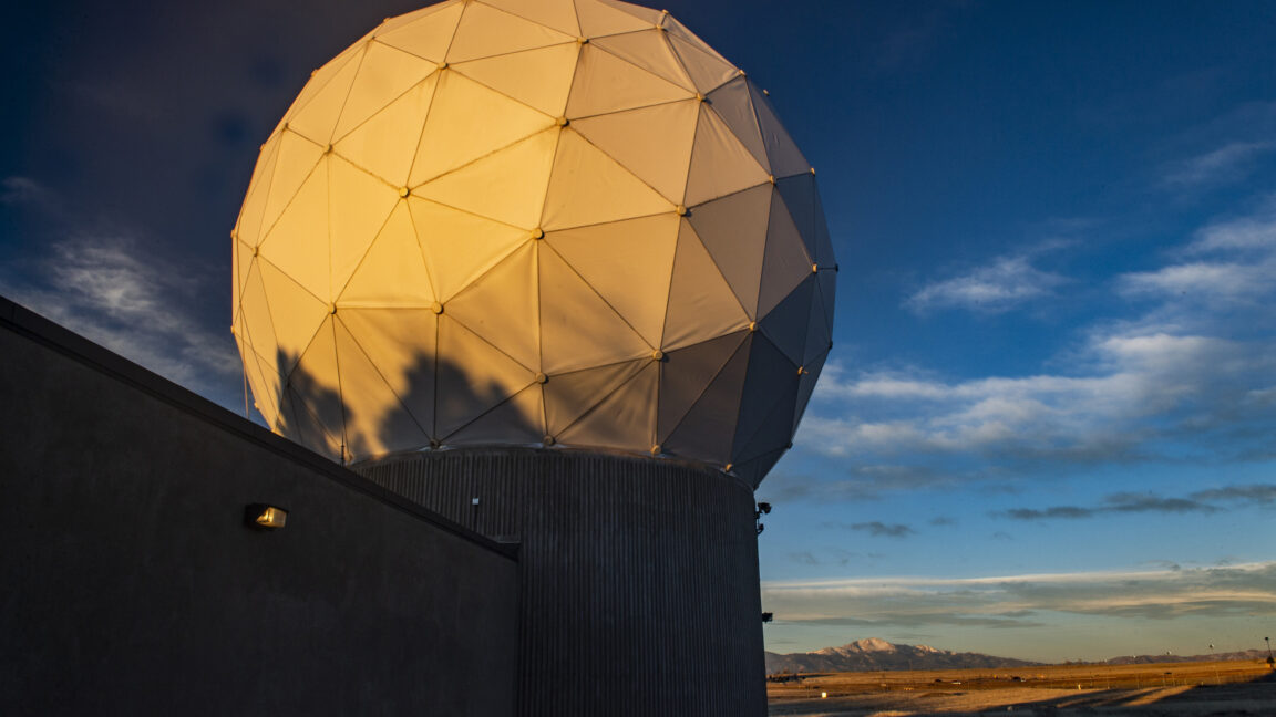
Article contents

Jason Rainbow 5–6 minutes NordSpace says its very low Earth orbit satellite platform is foundational for a future constellation combining low-latency connectivity with ultra-high-resolution Earth observation. Credit: NordSpace TAMPA, Fla. — NordSpace has secured early defense funding to develop a very low Earth orbit (VLEO) satellite, further broadening the Canadian startup’s push to build sovereign space capabilities beyond launch. The company announced a one-year contract April 21 worth around $183,000 from Canada’s Department of National Defence to advance conceptual technologies toward hardware tests. A NordSpace spokesperson said the technologies are critical for a proposed VLEO constellation called Kestrel that it aims to begin deploying from 2028 to provide low-latency, 10-centimeter spatial resolution imaging. “This is enabled by the much lower orbital altitudes and would be a game changer for defense and civilian applications,” the spokesperson said via email. “No commercial product offers this resolution today,” the spokesperson added, as U.S.-based Albedo and Redwire pursue similar VLEO capabilities. Key hurdles for VLEO include maintaining orbit against atmospheric drag and building an architecture that can support rapid satellite replenishment for sustainable operations. Initial Kestrel designs have a lifespan of around three years before burning up in the atmosphere, compared with about five years typically for satellites in low Earth orbit (LEO). The NordSpace spokesperson said future versions with improved propulsion and station-keeping could remain operational for much longer. The startup plans to lean on the launch capability it is developing to help replenish VLEO satellites, along with its dedicated spaceport in eastern Canada. NordSpace’s Tundra orbital rocket is slated to fly for the first time in 2028, while the maiden flight of its suborbital Taiga rocket is due in the coming months. Entering another orbital regime Founded in 2022, NordSpace is also preparing to deploy its self-built Terra Nova LEO imaging pathfinder this fall via a SpaceX rideshare mission. “Terra Nova is testing some of the key technologies we would deploy in our various orbital environments of interest, including VLEO,” the Nordspace spokesperson said. “It is launching with our own proprietary NVIDIA powered imaging system called Chronos with edge-AI image processing to reduce downlinked data by 100x, and our Zephyr in-space thruster to test station keeping.” NordSpace’s LEO pathfinder is slated to launch this fall to test technologies for future constellations, including systems to support VLEO spacecraft. Credit: NordSpace Plans to follow up the pathfinder with a Terra Nova constellation remain under wraps. Bolstering Canadian sovereignty Owning orbital launch capability would support broader efforts to strengthen Canada’s sovereign access to space, while reducing NordSpace’s reliance on third-party rideshare missions for constellation replenishment. “Those same rideshare opportunities, however, are what allow NordSpace to fly and validate its space systems today while we develop our own orbital launch systems,” NordSpace founder and CEO Rahul Goel told SpaceNews. “This brings our two divisions together in a way that simply wasn’t available to launch startups until very recently, and we’re taking full advantage of building a resilient space missions company today versus 10 or 20 years ago.” The VLEO funding comes through the Department of National Defence’s Innovation for Defence Excellence and Security (IDEaS) program. The venture has received more than 10 million Canadian dollars ($7.3 million) in grants so far, mostly from Launch the North, a Canadian defense initiative to boost sovereign launch-related capabilities. “Larger private capital investments in the company have been contributed by the founder and CEO, as a goal of the company is to achieve orbital flight with minimal dilutive financing,” the spokesperson added. NordSpace recently also created a venture capital arm to back domestic space companies, including Earth observation operator Wyvern.
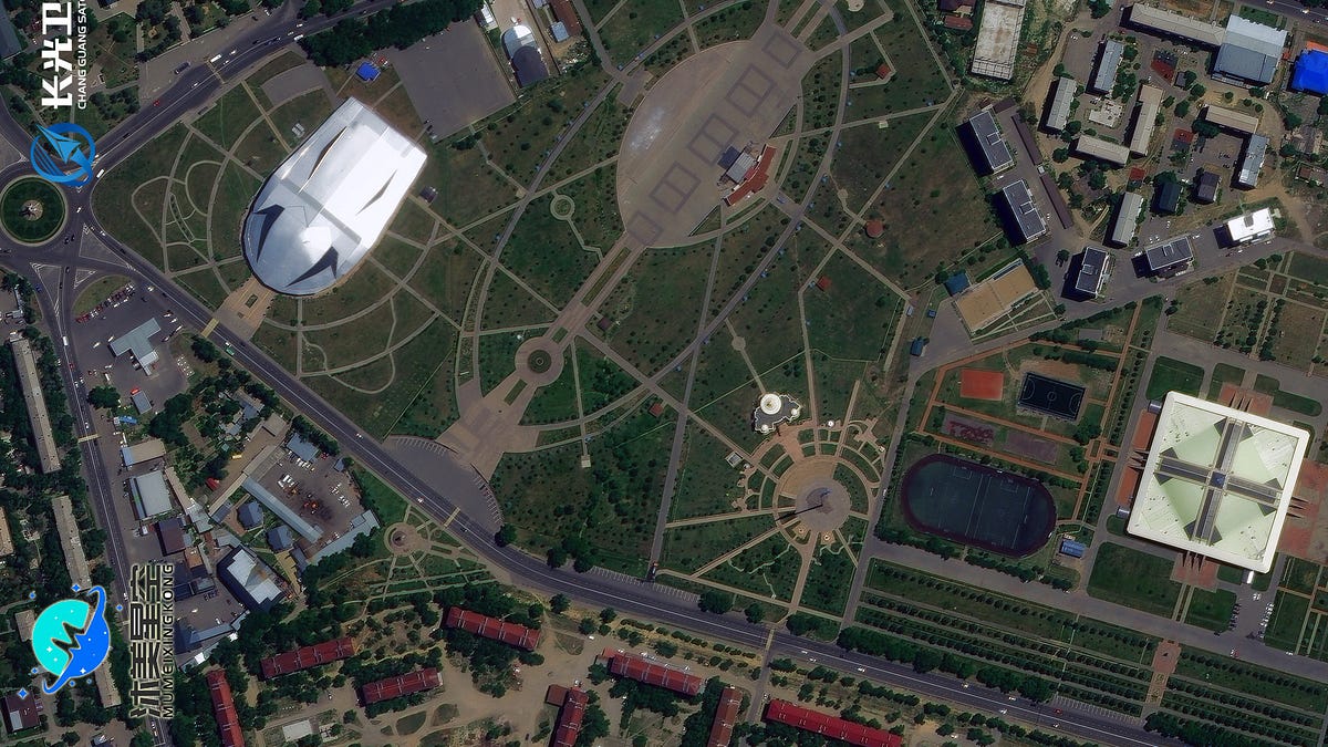
0

[Sandra Erwin] Space Force sets up ‘cislunar coordination’ office to focus beyond Earth orbit

SpaceNews Space Force sets up ‘cislunar coordination’ office to focus beyond Earth orbit spacenews.com
preview
Article text

Sandra Erwin 4–5 minutes WASHINGTON — The U.S. Space Force is setting up a dedicated acquisition office focused on cislunar space, the region between Earth and the moon, as it begins to more formally assess requirements beyond traditional Earth orbit. “We’re going to stand up a cislunar coordination office on the Space Force acquisition side to focus exactly on that,” Maj. Gen. Stephen Purdy, senior advisor to the secretary of the Air Force for space acquisition, said at the Space Symposium last week. The move follows the Trump administration’s December 2025 executive order, Ensuring American Space Superiority, which has begun to translate broad policy direction into acquisition priorities. The guidance is pushing cislunar space from an abstract concept into what officials increasingly describe as a future operating environment for national security. “We need to begin integrating cislunar capability into the Space Force,” Purdy said. “Certainly NASA’s Artemis 2 mission has captured our imagination, but we also need to understand the importance of the cislunar region for warfighting and national security.” The office will be led by Jaime Stearns, a veteran program manager with experience at the Space Rapid Capabilities Office and the Air Force Research Laboratory. Its mandate is expected to mirror earlier Space Force efforts to stand up new mission areas, combining engineering and program management expertise to map existing activity across government and industry and identify where to direct funding. “We built roadmaps, we built technology plans, we built schedules by documenting what everyone was doing in the government and in industry, and then figuring out where to apply dollars for maximum benefit,” Purdy said, describing the approach. The effort will rely heavily on collaboration, particularly with NASA, which leads U.S. civil exploration beyond Earth orbit. Purdy said NASA would be the “biggest partner,” alongside organizations such as the Air Force Research Laboratory and the Defense Innovation Unit. Senior military leadership has framed the initiative as a natural extension of U.S. activity in space. “Wherever U.S. interests go, so will go the US Space Force,” Chief of Space Operations Gen. Chance Saltzman told reporters last week. Saltzman said the service’s role would center on enabling access and sustaining operations rather than deploying forces in the traditional sense. “If our interests go to a lunar base, the Space Force will have to make sure that it’s safe to get out there … And once they’re there, that it’s sustainable,” he said. The executive order itself does not call for a military presence in cislunar space but directs the development of a sustained U.S. architecture beyond Earth orbit — transportation, communications and navigation systems — that inherently carries security implications. Those assets, once deployed, would require protection and continuous monitoring. The policy also reflects broader geopolitical considerations, with China’s lunar ambitions as a factor shaping planning assumptions. The U.S. military’s space tracking network is concentrated in low Earth orbit and geosynchronous orbit, leaving limited visibility farther out. Cislunar space presents a more complex tracking problem, with less predictable orbital dynamics and far greater distances, complicating what operators refer to as custody, or maintaining continuous awareness of objects over time. Objects operating in cislunar space could approach Earth orbit along trajectories that are difficult to detect with existing sensors, raising concerns about blind spots in space domain awareness.

Article text

Sandra Erwin 4–5 minutes WASHINGTON — The U.S. Space Force is setting up a dedicated acquisition office focused on cislunar space, the region between Earth and the moon, as it begins to more formally assess requirements beyond traditional Earth orbit. “We’re going to stand up a cislunar coordination office on the Space Force acquisition side to focus exactly on that,” Maj. Gen. Stephen Purdy, senior advisor to the secretary of the Air Force for space acquisition, said at the Space Symposium last week. The move follows the Trump administration’s December 2025 executive order, Ensuring American Space Superiority, which has begun to translate broad policy direction into acquisition priorities. The guidance is pushing cislunar space from an abstract concept into what officials increasingly describe as a future operating environment for national security. “We need to begin integrating cislunar capability into the Space Force,” Purdy said. “Certainly NASA’s Artemis 2 mission has captured our imagination, but we also need to understand the importance of the cislunar region for warfighting and national security.” The office will be led by Jaime Stearns, a veteran program manager with experience at the Space Rapid Capabilities Office and the Air Force Research Laboratory. Its mandate is expected to mirror earlier Space Force efforts to stand up new mission areas, combining engineering and program management expertise to map existing activity across government and industry and identify where to direct funding. “We built roadmaps, we built technology plans, we built schedules by documenting what everyone was doing in the government and in industry, and then figuring out where to apply dollars for maximum benefit,” Purdy said, describing the approach. The effort will rely heavily on collaboration, particularly with NASA, which leads U.S. civil exploration beyond Earth orbit. Purdy said NASA would be the “biggest partner,” alongside organizations such as the Air Force Research Laboratory and the Defense Innovation Unit. Senior military leadership has framed the initiative as a natural extension of U.S. activity in space. “Wherever U.S. interests go, so will go the US Space Force,” Chief of Space Operations Gen. Chance Saltzman told reporters last week. Saltzman said the service’s role would center on enabling access and sustaining operations rather than deploying forces in the traditional sense. “If our interests go to a lunar base, the Space Force will have to make sure that it’s safe to get out there … And once they’re there, that it’s sustainable,” he said. The executive order itself does not call for a military presence in cislunar space but directs the development of a sustained U.S. architecture beyond Earth orbit — transportation, communications and navigation systems — that inherently carries security implications. Those assets, once deployed, would require protection and continuous monitoring. The policy also reflects broader geopolitical considerations, with China’s lunar ambitions as a factor shaping planning assumptions. The U.S. military’s space tracking network is concentrated in low Earth orbit and geosynchronous orbit, leaving limited visibility farther out. Cislunar space presents a more complex tracking problem, with less predictable orbital dynamics and far greater distances, complicating what operators refer to as custody, or maintaining continuous awareness of objects over time. Objects operating in cislunar space could approach Earth orbit along trajectories that are difficult to detect with existing sensors, raising concerns about blind spots in space domain awareness.

0

[Jason Rainbow] Astroscale passes key design milestone for UK military space-tracking cubesats

SpaceNews Astroscale passes key design milestone for UK military space-tracking cubesats spacenews.com
preview
Article text

Jason Rainbow 3–4 minutes An illustration of the two Orpheus cubesats that Astroscale plans to operate in low Earth orbit. Credit: Astroscale TAMPA, Fla. — Astroscale has completed the critical design review for two cubesats slated to launch next year to help the British military monitor space weather and track objects in low Earth orbit (LEO). The U.K. subsidiary of the Japanese on-orbit servicing venture announced the milestone April 8 for the Orpheus mission, which was fully funded last year under a 5.15 million British pound ($7 million) contract from the U.K.’s Defence Science and Technology Laboratory (Dstl). The mission involves flying a pair of near-identical 12U spacecraft from British small satellite specialist Open Cosmos in close formation for a year in LEO, where onboard hyperspectral imaging sensors would detect and identify targets of interest. International partners, including the U.S. Naval Research Laboratory and Defence Research and Development Canada, are also providing payloads enabling the satellites to study geophysical activity that can disrupt navigation systems and communications. Astroscale would operate the spacecraft, drawing on rendezvous and proximity operations (RPO) expertise demonstrated during a 2021 satellite capture test and a more recent mission that carried out a close inspection of space debris. Andrew Robinson, Dstl space systems program manager, said Orpheus will deliver vital research for the agency while playing a “key role in advancing the U.K.’s ability to design, build and deliver space systems for the future.” Alex Godfrey, head of defense for Astroscale’s British subsidiary, said the U.K. and its allies will be able to draw upon data collected by the Orpheus spacecraft to improve their space domain awareness (SDA) capabilities. “This includes accurate characterization of the dynamic ionosphere, informing ionospheric models to improve our ability to specify the impact of space weather, in addition to spectral sensing for Earth observation and SDA applications,” Godfrey said. “To ensure that data is useful to international collaborators, a lot of effort is placed on working towards a joint space architecture, which aims to enable more collaborative mission planning, satellite tasking and data dissemination across international partners.” Astroscale said it expects Orpheus to reach its next milestone in the third quarter of 2026, marking where the build of both satellites are complete and the mission is ready to begin the testing phase, ahead of launch in the first half of 2027.


Article text

Jason Rainbow 3–4 minutes An illustration of the two Orpheus cubesats that Astroscale plans to operate in low Earth orbit. Credit: Astroscale TAMPA, Fla. — Astroscale has completed the critical design review for two cubesats slated to launch next year to help the British military monitor space weather and track objects in low Earth orbit (LEO). The U.K. subsidiary of the Japanese on-orbit servicing venture announced the milestone April 8 for the Orpheus mission, which was fully funded last year under a 5.15 million British pound ($7 million) contract from the U.K.’s Defence Science and Technology Laboratory (Dstl). The mission involves flying a pair of near-identical 12U spacecraft from British small satellite specialist Open Cosmos in close formation for a year in LEO, where onboard hyperspectral imaging sensors would detect and identify targets of interest. International partners, including the U.S. Naval Research Laboratory and Defence Research and Development Canada, are also providing payloads enabling the satellites to study geophysical activity that can disrupt navigation systems and communications. Astroscale would operate the spacecraft, drawing on rendezvous and proximity operations (RPO) expertise demonstrated during a 2021 satellite capture test and a more recent mission that carried out a close inspection of space debris. Andrew Robinson, Dstl space systems program manager, said Orpheus will deliver vital research for the agency while playing a “key role in advancing the U.K.’s ability to design, build and deliver space systems for the future.” Alex Godfrey, head of defense for Astroscale’s British subsidiary, said the U.K. and its allies will be able to draw upon data collected by the Orpheus spacecraft to improve their space domain awareness (SDA) capabilities. “This includes accurate characterization of the dynamic ionosphere, informing ionospheric models to improve our ability to specify the impact of space weather, in addition to spectral sensing for Earth observation and SDA applications,” Godfrey said. “To ensure that data is useful to international collaborators, a lot of effort is placed on working towards a joint space architecture, which aims to enable more collaborative mission planning, satellite tasking and data dissemination across international partners.” Astroscale said it expects Orpheus to reach its next milestone in the third quarter of 2026, marking where the build of both satellites are complete and the mission is ready to begin the testing phase, ahead of launch in the first half of 2027.
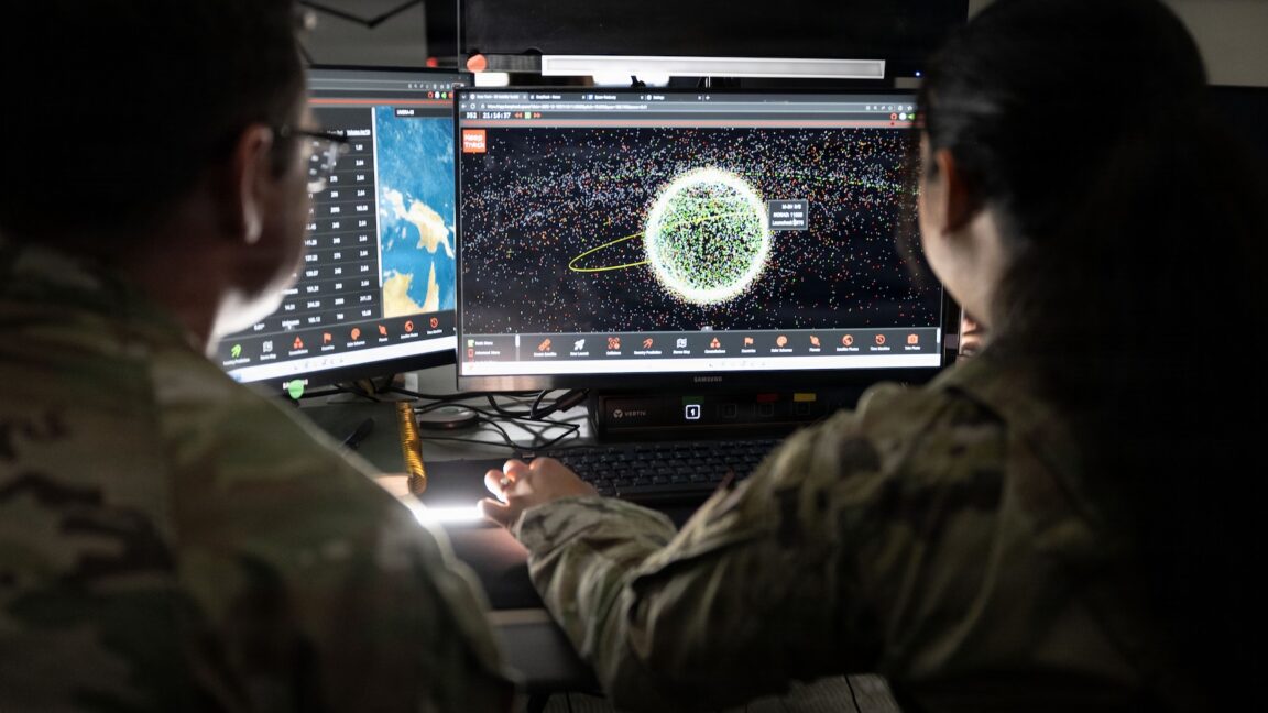
0

[Jason Rainbow] Aspect Aerospace secures early funding to advance swarm-deployable VLEO satellites

SpaceNews Aspect Aerospace secures early funding to advance swarm-deployable VLEO satellites spacenews.com
preview
Article text

Jason Rainbow 6–7 minutes TAMPA, Fla. — Aspect Aerospace, a University of South Alabama spin-off, has secured $2.4 million to develop circuit-board-sized spacecraft that could be deployed from space into very low Earth orbit (VLEO) in swarms to monitor the space environment. The funding includes a $1.9 million U.S. Space Force grant to build a space-ready Single-Board Satellite (SBS) prototype within 18 months, the startup announced April 1, and a $500,000 pre-seed investment from venture capital firm SOSV. The SBS would integrate sensing, communications and power systems onto a single printed circuit board, with units designed to last about six months in VLEO. According to Aspect Aerospace, a host spacecraft about the size of a dorm fridge could carry up to 100 of them for individual or batch deployment from a more stable orbit just above VLEO, at roughly the cost of a single conventional ESPA-class satellite. “The ability of Aspect Aerospace’s SBS to remain stored on orbit in large numbers and be deployed in response to events is unprecedented,” said cofounder and CEO Drew Russ. “By implementing a satellite on a single printed-circuit board, size, weight, and cost are minimized and the satellite can be manufactured cost-effectively in high volume.” Improving space-weather visibility Aspect Aerospace’s initial focus is on monitoring plasma in VLEO, where space weather and atmospheric drag can significantly affect satellite operations. Today, plasma is primarily measured using radio occultation. “This is a coarse measurement,” Russ said, “it sums the plasma over a multi-hundred-kilometer path — and provides no insight into the distribution of plasma along the path. In fact, the method is so coarse that plasma is treated as if it exists at a single altitude, in effect a two-dimensional model.” Aspect Aerospace’s system instead uses a proprietary time-domain impedance probe (TDIP) sensor to take near-instantaneous point measurements. As individual SBS units move through orbit, Russ said they would generate high-resolution data that can be combined across a constellation to produce a three-dimensional model of plasma with sub-meter precision. “The high‑fidelity data is a game‑changer for satellite operators,” he told SpaceNews via email, “enhancing communication‑link optimization, delivering accurate space‑weather storm alerts, supporting safe‑mode decisions and powering many other mission‑critical applications.” The SBS builds on earlier work with Jagsat-1, a 2U cubesat deployed from the International Space Station into the low end of low Earth orbit (LEO) in 2022, which Russ said validated its space-weather sensor before de-orbiting. He said additional suborbital tests and independent validation by the U.S. Naval Research Laboratory confirmed the sensor’s near-instantaneous measurement capabilities. Beyond plasma monitoring, the data could also be used to map atmospheric drag in VLEO. “This data is valuable across the space industry,” Russ said, “anyone downlinking data from space, sending signals up to satellites, or operating in LEO need to know about this environment.” Every radio signal traveling to or from a satellite passes through the ionosphere, where changing conditions can disrupt communications, particularly during severe space-weather events. “The impact is spacecraft have to re-do downlinks and lose valuable time on orbit waiting to send data down, consuming power and increasing latency,” he added. “Our data enables operators to optimize when and where to downlink, how to tune parameters for optimal uplink for ground stations and let spacecraft operators minimize time in safe mode due to inclement space weather. Providing particle density data to inform spacecraft drag is another use case that provides an additional market opportunity within space operations.” Path to orbit The Space Force’s Direct-to-Phase-2 Small Business Innovation Research (SBIR) award allows Aspect Aerospace to bypass Phase 1 and move directly toward building a flight-ready system. “We’re lucky that our first mission won’t just be a ‘demonstrator,’ but a true science-generating mission, exploring a largely unexplored region of space with unprecedented accuracy and more capable sensing technology,” Russ said. Aspect Aerospace is targeting early 2027 to deploy on orbit, pending negotiations with launch and mission operations partners as it pursues plans for persistent SBS hosting in space. Operating in a harsh orbital regime “VLEO is an extremely harsh environment, and exotic spacecraft architectures are needed to have a persistent presence in the region,” Russ said. “For some, that means extremely expensive, new technologies like air-breathing engines, letting them deploy a small number of large spacecraft into VLEO. Aspect Aerospace has taken the opposite approach. Our spacecraft are extremely small and low cost, letting us put full-scale constellations in a region where others struggle to deploy even a single satellite.” From above VLEO, Russ said a host satellite could last five years in orbit while deploying five to 10 SBS units at a regular cadence. “Other missions might involve having a host dwell for a long time before independently tasking and deploying batches on-demand in response to timing-critical events,” he added. “Other missions may want to immediately deploy all 100 at once.” Aspect Aerospace is also seeking partners to expand beyond plasma monitoring and use the SBS architecture to host magnetometers, infrared spectrometers, radiation and other sensors. “We foresee the potential to create a full constellation of novel sensor types for the cost of a single conventional satellite, expanding the envelope of possibilities for space-based environmental monitoring,” he said.

Article text

Jason Rainbow 6–7 minutes TAMPA, Fla. — Aspect Aerospace, a University of South Alabama spin-off, has secured $2.4 million to develop circuit-board-sized spacecraft that could be deployed from space into very low Earth orbit (VLEO) in swarms to monitor the space environment. The funding includes a $1.9 million U.S. Space Force grant to build a space-ready Single-Board Satellite (SBS) prototype within 18 months, the startup announced April 1, and a $500,000 pre-seed investment from venture capital firm SOSV. The SBS would integrate sensing, communications and power systems onto a single printed circuit board, with units designed to last about six months in VLEO. According to Aspect Aerospace, a host spacecraft about the size of a dorm fridge could carry up to 100 of them for individual or batch deployment from a more stable orbit just above VLEO, at roughly the cost of a single conventional ESPA-class satellite. “The ability of Aspect Aerospace’s SBS to remain stored on orbit in large numbers and be deployed in response to events is unprecedented,” said cofounder and CEO Drew Russ. “By implementing a satellite on a single printed-circuit board, size, weight, and cost are minimized and the satellite can be manufactured cost-effectively in high volume.” Improving space-weather visibility Aspect Aerospace’s initial focus is on monitoring plasma in VLEO, where space weather and atmospheric drag can significantly affect satellite operations. Today, plasma is primarily measured using radio occultation. “This is a coarse measurement,” Russ said, “it sums the plasma over a multi-hundred-kilometer path — and provides no insight into the distribution of plasma along the path. In fact, the method is so coarse that plasma is treated as if it exists at a single altitude, in effect a two-dimensional model.” Aspect Aerospace’s system instead uses a proprietary time-domain impedance probe (TDIP) sensor to take near-instantaneous point measurements. As individual SBS units move through orbit, Russ said they would generate high-resolution data that can be combined across a constellation to produce a three-dimensional model of plasma with sub-meter precision. “The high‑fidelity data is a game‑changer for satellite operators,” he told SpaceNews via email, “enhancing communication‑link optimization, delivering accurate space‑weather storm alerts, supporting safe‑mode decisions and powering many other mission‑critical applications.” The SBS builds on earlier work with Jagsat-1, a 2U cubesat deployed from the International Space Station into the low end of low Earth orbit (LEO) in 2022, which Russ said validated its space-weather sensor before de-orbiting. He said additional suborbital tests and independent validation by the U.S. Naval Research Laboratory confirmed the sensor’s near-instantaneous measurement capabilities. Beyond plasma monitoring, the data could also be used to map atmospheric drag in VLEO. “This data is valuable across the space industry,” Russ said, “anyone downlinking data from space, sending signals up to satellites, or operating in LEO need to know about this environment.” Every radio signal traveling to or from a satellite passes through the ionosphere, where changing conditions can disrupt communications, particularly during severe space-weather events. “The impact is spacecraft have to re-do downlinks and lose valuable time on orbit waiting to send data down, consuming power and increasing latency,” he added. “Our data enables operators to optimize when and where to downlink, how to tune parameters for optimal uplink for ground stations and let spacecraft operators minimize time in safe mode due to inclement space weather. Providing particle density data to inform spacecraft drag is another use case that provides an additional market opportunity within space operations.” Path to orbit The Space Force’s Direct-to-Phase-2 Small Business Innovation Research (SBIR) award allows Aspect Aerospace to bypass Phase 1 and move directly toward building a flight-ready system. “We’re lucky that our first mission won’t just be a ‘demonstrator,’ but a true science-generating mission, exploring a largely unexplored region of space with unprecedented accuracy and more capable sensing technology,” Russ said. Aspect Aerospace is targeting early 2027 to deploy on orbit, pending negotiations with launch and mission operations partners as it pursues plans for persistent SBS hosting in space. Operating in a harsh orbital regime “VLEO is an extremely harsh environment, and exotic spacecraft architectures are needed to have a persistent presence in the region,” Russ said. “For some, that means extremely expensive, new technologies like air-breathing engines, letting them deploy a small number of large spacecraft into VLEO. Aspect Aerospace has taken the opposite approach. Our spacecraft are extremely small and low cost, letting us put full-scale constellations in a region where others struggle to deploy even a single satellite.” From above VLEO, Russ said a host satellite could last five years in orbit while deploying five to 10 SBS units at a regular cadence. “Other missions might involve having a host dwell for a long time before independently tasking and deploying batches on-demand in response to timing-critical events,” he added. “Other missions may want to immediately deploy all 100 at once.” Aspect Aerospace is also seeking partners to expand beyond plasma monitoring and use the SBS architecture to host magnetometers, infrared spectrometers, radiation and other sensors. “We foresee the potential to create a full constellation of novel sensor types for the cost of a single conventional satellite, expanding the envelope of possibilities for space-based environmental monitoring,” he said.