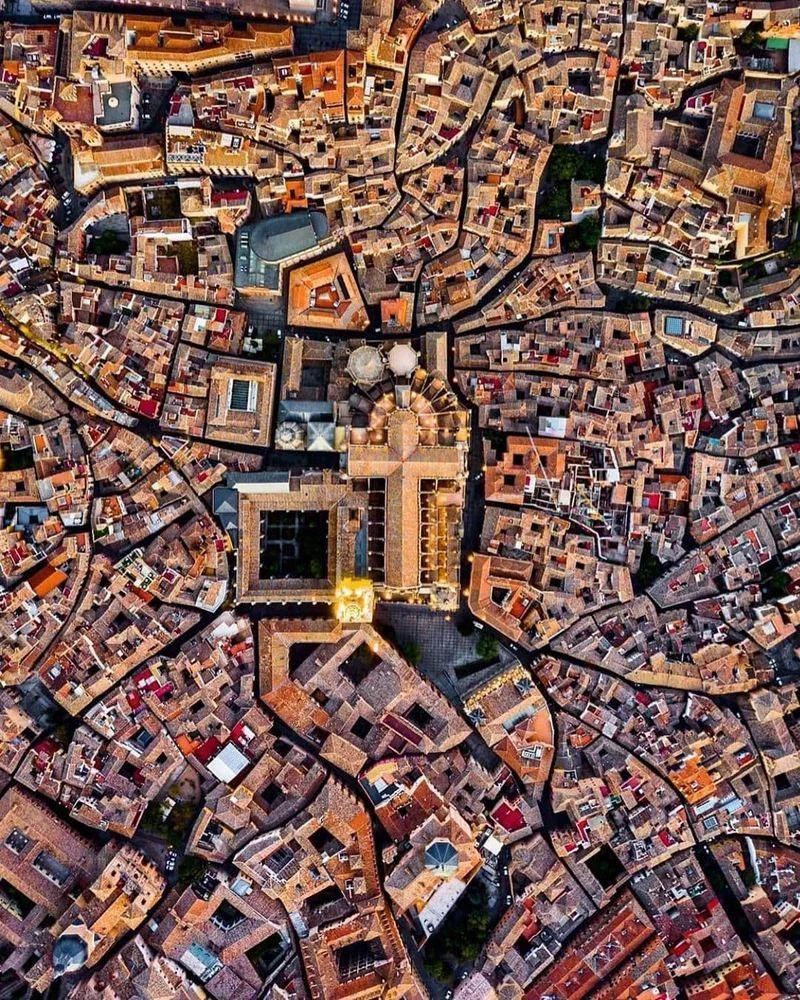
A photo by copenhagenbycosedis
Their description on FB:
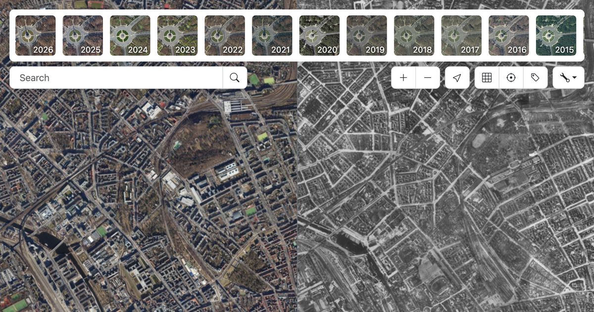
Seen from above, Dybbølsgade reveals one of the more intriguing details in the urban structure of Vesterbro. While many surrounding streets follow a relatively regular pattern of parallel lines and rectangular blocks, Dybbølsgade cuts diagonally through the neighbourhood, creating angled intersections and unusually shaped corners.
The street belongs to the enormous expansion of Vesterbro during the second half of the 19th century. As Copenhagen grew beyond its old fortifications, industrialisation attracted thousands of new residents, and large areas outside the historic city were rapidly developed with dense residential blocks.
Much of the architecture around Dybbølsgade reflects this period. The area contains many examples of the historicist residential architecture that characterised Copenhagen’s expansion from the 1870s onwards. Brickwork, stucco, cornices and carefully arranged windows brought variation to otherwise densely constructed streets and blocks.
The name Dybbølsgade also connects the neighbourhood to Danish history. Several streets on Vesterbro were named after places in Sønderjylland and Slesvig associated with the conflicts of the 19th century. Dybbølsgade refers to Dybbøl, the site of the decisive battle in 1864. Nearby names such as Istedgade, Haderslevgade and Sundevedsgade belong to the same geographical and historical tradition.
Vesterbro changed considerably during the 20th century, including major urban renewal and demolition, while much of its original street structure survived.
From street level, Dybbølsgade appears as one of many characteristic residential streets of Vesterbro. From above, however, its geometry becomes its defining feature. The diagonal street cuts through the surrounding grid, revealing how this part of Copenhagen developed through different streets, blocks and phases of urban expansion
A photo by copenhagenbycosedis
Their description on FB:
Seen from above, Dybbølsgade reveals one of the more intriguing details in the urban structure of Vesterbro. While many surrounding streets follow a relatively regular pattern of parallel lines and rectangular blocks, Dybbølsgade cuts diagonally through the neighbourhood, creating angled intersections and unusually shaped corners.
The street belongs to the enormous expansion of Vesterbro during the second half of the 19th century. As Copenhagen grew beyond its old fortifications, industrialisation attracted thousands of new residents, and large areas outside the historic city were rapidly developed with dense residential blocks.
Much of the architecture around Dybbølsgade reflects this period. The area contains many examples of the historicist residential architecture that characterised Copenhagen’s expansion from the 1870s onwards. Brickwork, stucco, cornices and carefully arranged windows brought variation to otherwise densely constructed streets and blocks.
The name Dybbølsgade also connects the neighbourhood to Danish history. Several streets on Vesterbro were named after places in Sønderjylland and Slesvig associated with the conflicts of the 19th century. Dybbølsgade refers to Dybbøl, the site of the decisive battle in 1864. Nearby names such as Istedgade, Haderslevgade and Sundevedsgade belong to the same geographical and historical tradition.
Vesterbro changed considerably during the 20th century, including major urban renewal and demolition, while much of its original street structure survived.
From street level, Dybbølsgade appears as one of many characteristic residential streets of Vesterbro. From above, however, its geometry becomes its defining feature. The diagonal street cuts through the surrounding grid, revealing how this part of Copenhagen developed through different streets, blocks and phases of urban expansion
Deepwater Pump Track officially opens today (Wednesday, April 15), transforming a once-underused patch of parkland into a full-throttle playground for cyclists, scooter riders and anyone keen to get their wheels off the ground.
Deepwater Pump Track officially opens today (Wednesday, April 15), transforming a once-underused patch of parkland into a full-throttle playground for cyclists, scooter riders and anyone keen to get their wheels off the ground.
Also known as the Sea of Plastic, the greenhouses that now cover more than 40,000 hectares of the Spanish province of Almería are said to be easily visible from space. More info here.
Also known as the Sea of Plastic, the greenhouses that now cover more than 40,000 hectares of the Spanish province of Almería are said to be easily visible from space. More info here.
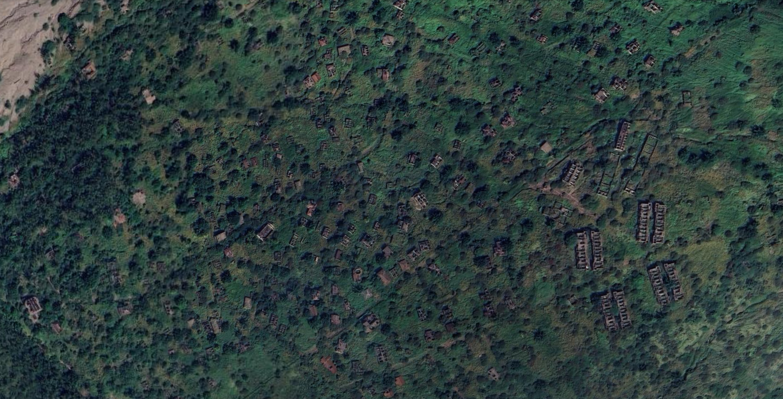
The former capital of the Caribbean island of Montserrat, a British overseas territory, has been fully abandoned since 1997 due to a series of eruptions at the Soufrière Hills volcano.
More info here.
The former capital of the Caribbean island of Montserrat, a British overseas territory, has been fully abandoned since 1997 due to a series of eruptions at the Soufrière Hills volcano.
More info here.
I was randomly browsing Google Earth and had drifted into Hungary when I noticed that many plots there, are elongated. They have a short front towards a road, where a house or structure usually is located, but then extend a pretty long way behind that!
I was randomly browsing Google Earth and had drifted into Hungary when I noticed that many plots there, are elongated. They have a short front towards a road, where a house or structure usually is located, but then extend a pretty long way behind that!
Summer residences close to Copenhagen in Denmark. The hedges are angled, from 180cm to 80 cm, securing privacy and optimal light access for plants close to the tip of the “slices”.
All homes have access to electricity, water, sewage and water. The houses must be less than 50 square meters, and you can only live there between April 1st to October 1st. Outside this period you can only stay there on weekends.
Summer residences close to Copenhagen in Denmark. The hedges are angled, from 180cm to 80 cm, securing privacy and optimal light access for plants close to the tip of the “slices”.
All homes have access to electricity, water, sewage and water. The houses must be less than 50 square meters, and you can only live there between April 1st to October 1st. Outside this period you can only stay there on weekends.
Dyrehavsbakken, is located approximately 10km North of Copenhagen Denmark.
Interestingly, Copenhagen has the third oldest operating amusement park Tivoli, that opened in 1843 (180 years ago)
Here is an overview shot of Tivoli in the center of Copenhagen
Dyrehavsbakken, is located approximately 10km North of Copenhagen Denmark.
Interestingly, Copenhagen has the third oldest operating amusement park Tivoli, that opened in 1843 (180 years ago)
Here is an overview shot of Tivoli in the center of Copenhagen
Built as a royal hunting lodge in the early 18th century
Today, the Palace of Stupinigi houses the Museo di Arte e Ammobiliamento, a museum of the arts and furnishings, some original to the palazzina, others brought from the former Savoy family residences of Moncalieri and Venaria Reale
Built as a royal hunting lodge in the early 18th century
Today, the Palace of Stupinigi houses the Museo di Arte e Ammobiliamento, a museum of the arts and furnishings, some original to the palazzina, others brought from the former Savoy family residences of Moncalieri and Venaria Reale
I only noticed today, due to the Tour de France finishing there, but Rimini has some huge beaches! Also they seem to have constructed some sort of wave breaker, to give calmer waters for visitors (?). It does look amazin from a distance
Slightly furhter north, still in Rimini, but on the other side of “Porto di Rimini” the beaches get even larger!
I only noticed today, due to the Tour de France finishing there, but Rimini has some huge beaches! Also they seem to have constructed some sort of wave breaker, to give calmer waters for visitors (?). It does look amazin from a distance
Slightly furhter north, still in Rimini, but on the other side of “Porto di Rimini” the beaches get even larger!
ORP Wicher ORP Wicher (English: Whirlwind) was a Project 30bis destroyer, transferred to the People’s Republic of Poland from the Soviet Union in 1958.[2] She was built by the Zhdanov shipyard in Leningrad and originally commissioned into the Soviet Baltic Fleet as the Skoryy (“Rapid”) in 1951, and transferred to Poland in 1958 together with a second ship, ORP Grom.
ORP Grom was the lead ship of her class of destroyers serving in the Polish Navy during World War II. She was named after the Polish word for Thunderbolt, while her sister ship ORP Błyskawica translates to lightning
ORP Wicher ORP Wicher (English: Whirlwind) was a Project 30bis destroyer, transferred to the People’s Republic of Poland from the Soviet Union in 1958.[2] She was built by the Zhdanov shipyard in Leningrad and originally commissioned into the Soviet Baltic Fleet as the Skoryy (“Rapid”) in 1951, and transferred to Poland in 1958 together with a second ship, ORP Grom.
ORP Grom was the lead ship of her class of destroyers serving in the Polish Navy during World War II. She was named after the Polish word for Thunderbolt, while her sister ship ORP Błyskawica translates to lightning
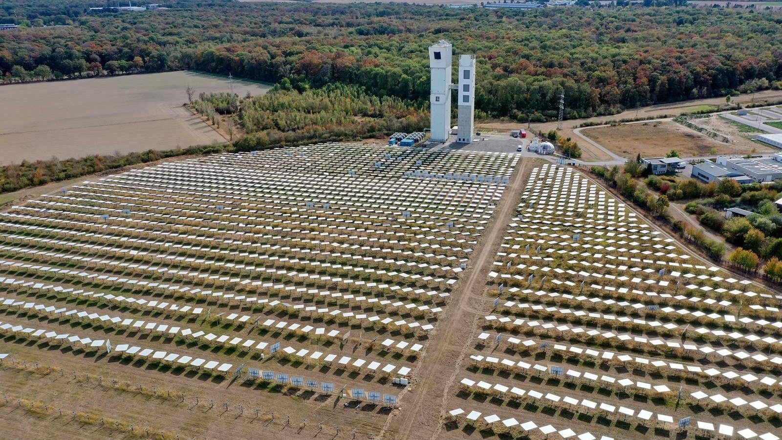
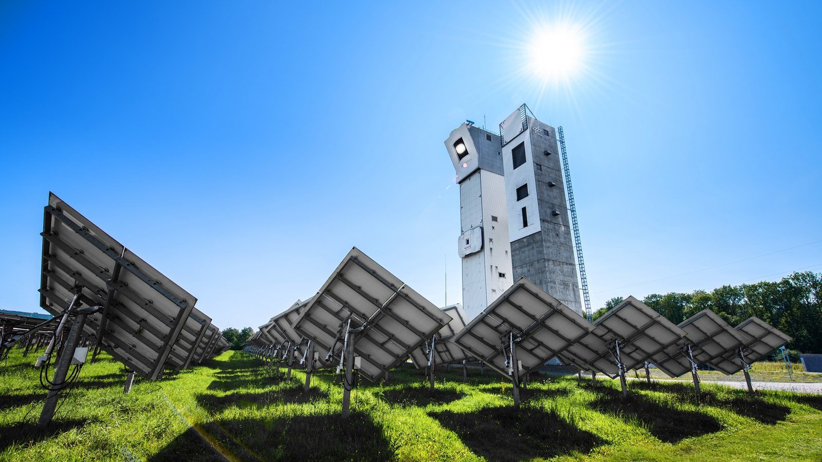
Testsing and development of components and systems for commercial solar thermal power plants. The aim is to make solar thermal power plants more efficient. They also test processes for solar water splitting, the production of solar fuels and the use of solar heat in industrial processes.
More than 2,000 movable mirrors (heliostats) cover an area of around ten hectares in front of Jülich’s two solar towers. They catch the sunlight, concentrate it and direct it onto the two solar towers.
In the solar tower power plant, a volumetric receiver at the top of the tower absorbs the concentrated sunlight and uses it to heat the surrounding air to up to 700 degrees Celsius. A steam generator inside the tower uses this to heat water into steam, which drives a turbine that produces electricity via a generator.
Testsing and development of components and systems for commercial solar thermal power plants. The aim is to make solar thermal power plants more efficient. They also test processes for solar water splitting, the production of solar fuels and the use of solar heat in industrial processes.
More than 2,000 movable mirrors (heliostats) cover an area of around ten hectares in front of Jülich’s two solar towers. They catch the sunlight, concentrate it and direct it onto the two solar towers.
In the solar tower power plant, a volumetric receiver at the top of the tower absorbs the concentrated sunlight and uses it to heat the surrounding air to up to 700 degrees Celsius. A steam generator inside the tower uses this to heat water into steam, which drives a turbine that produces electricity via a generator.
If there is one thing that I keep noticing, when I look for cool places from above, it is golf courses! There are so many, and they are everywhere! This one is Murasaki Golf Club, with 27 holes, and 108 par.
The largest golf course I could find, is Mission Hill Resort in Shenzhen China. It has 12 courses, with 18 holes. 216 holes in total. Id does, IMO not look quite as good as the one from Murasaki
If there is one thing that I keep noticing, when I look for cool places from above, it is golf courses! There are so many, and they are everywhere! This one is Murasaki Golf Club, with 27 holes, and 108 par.
The largest golf course I could find, is Mission Hill Resort in Shenzhen China. It has 12 courses, with 18 holes. 216 holes in total. Id does, IMO not look quite as good as the one from Murasaki
This may not look like much if you don’t watch motorsports, and in particular the 24hr Endurance race in Le Mans, but if you do, you may be able to identify the classic track on this map!
Bellow are a few closeups of some of the most legendary corners
This may not look like much if you don’t watch motorsports, and in particular the 24hr Endurance race in Le Mans, but if you do, you may be able to identify the classic track on this map!
Bellow are a few closeups of some of the most legendary corners